Piri Reis
Map of the Dalmatian Islands: Korcula and Lastovo Off the Coast Between Dubrovnik and Split
late 11th century AH/AD 17th century-early 12th century AH/AD 18th century (Ottoman)
W.658.154B
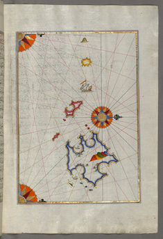
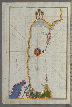
Map of Two Unnamed Island Between Dubrovnik and Split
late 11th century AH/AD 17th century-early 12th century AH/AD 18th century (Ottoman)
W.658.155B
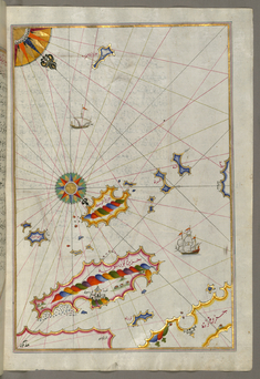
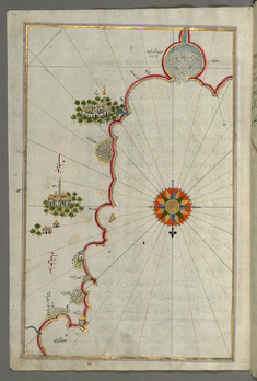
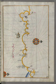
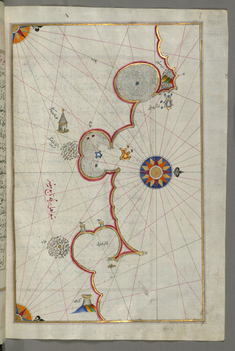
Map of a Group of Islands North of Korcula, Probably Hvar and Brac
late 11th century AH/AD 17th century-early 12th century AH/AD 18th century (Ottoman)
W.658.157A
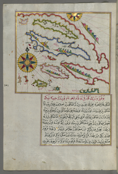
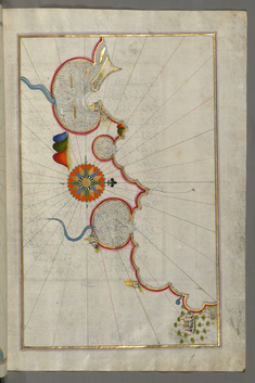
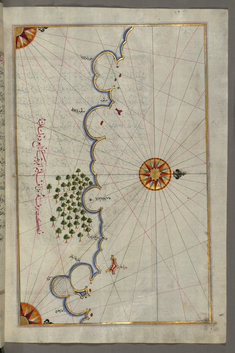
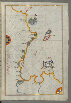
Map of the Coastline and the Islands Between Šibenik and Zadar
late 11th century AH/AD 17th century-early 12th century AH/AD 18th century (Ottoman)
W.658.158A
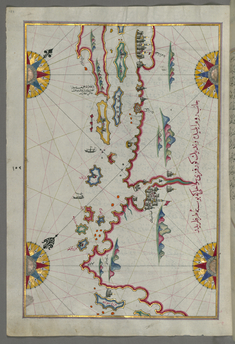
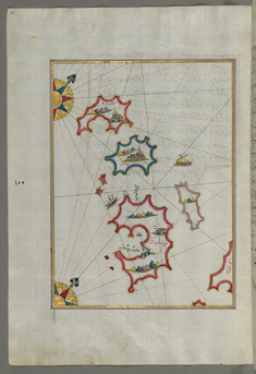
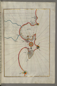
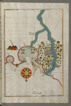
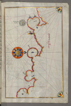
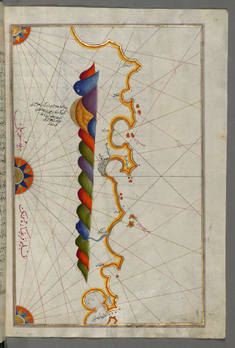
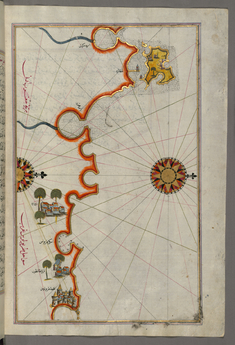
Map of the Coastline and the Islands Off Zadar
late 11th century AH/AD 17th century-early 12th century AH/AD 18th century (Ottoman)
W.658.160A
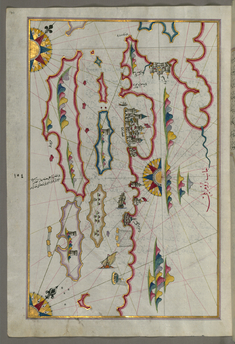
Map of Small Islands Northwest of the Pag Island
late 11th century AH/AD 17th century-early 12th century AH/AD 18th century (Ottoman)
W.658.161A
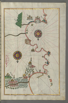
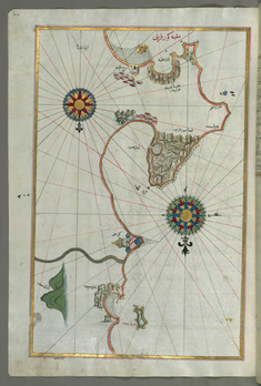
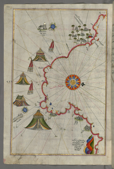
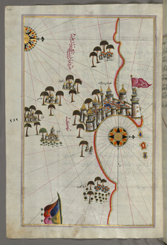
Map of the Eastern Mediterranean Coast and City of Tripoli
late 11th century AH/AD 17th century-early 12th century AH/AD 18th century (Ottoman)
W.658.317B
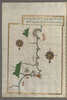
Map of the Eastern Mediterranean Coast as Far as the City of Beirut
late 11th century AH/AD 17th century-early 12th century AH/AD 18th century (Ottoman)
W.658.316A
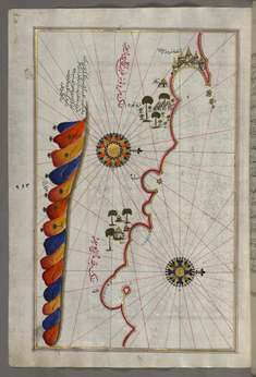
Map of the Eastern Mediterranean Coast with the City of Tyre
late 11th century AH/AD 17th century-early 12th century AH/AD 18th century (Ottoman)
W.658.315A
Map of the Eastern Mediterranean Coastline with the Cities of Jaffa and Caesarea
late 11th century AH/AD 17th century-early 12th century AH/AD 18th century (Ottoman)
W.658.313B
Map of the "Syrian Coast" and the Cities: Gaza and Ramlah
late 11th century AH/AD 17th century-early 12th century AH/AD 18th century (Ottoman)
W.658.312A
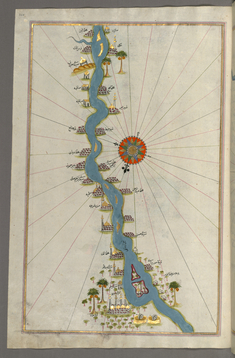
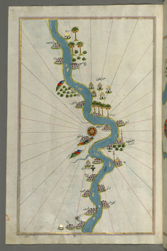
Map of the Oases and Villages Along the River Nile as Far as Sidi Musá
late 11th century AH/AD 17th century-early 12th century AH/AD 18th century (Ottoman)
W.658.310B
Map of Oases and Villages Along the River Nile as Far as Sidi Musá
late 11th century AH/AD 17th century-early 12th century AH/AD 18th century (Ottoman)
W.658.310A
Map of an Unmarked Part of the Egyptian Coastline
late 11th century AH/AD 17th century-early 12th century AH/AD 18th century (Ottoman)
W.658.309B
Map of the City of Damietta on the Egyptian Coast
late 11th century AH/AD 17th century-early 12th century AH/AD 18th century (Ottoman)
W.658.308B
Map of Towns and Oases Along the River Nile Beginning with Bulaq
late 11th century AH/AD 17th century-early 12th century AH/AD 18th century (Ottoman)
W.658.307B
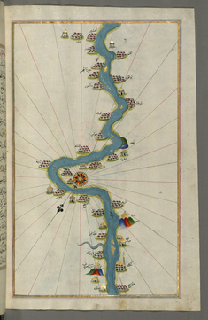
Map of the River Nile with Various Oases on Each Side
late 11th century AH/AD 17th century-early 12th century AH/AD 18th century (Ottoman)
W.658.307A
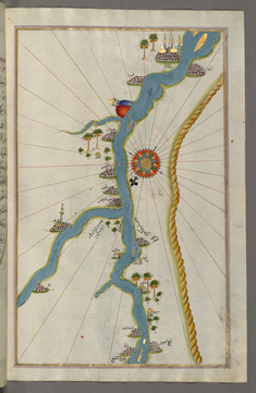
Map of the River Nile Estuary with the Cities of Rashid and Burullus on Each Side
late 11th century AH/AD 17th century-early 12th century AH/AD 18th century (Ottoman)
W.658.306B
Map of the Egyptian Coast From Alexandria as Far as the City of Rashid
late 11th century AH/AD 17th century-early 12th century AH/AD 18th century (Ottoman)
W.658.303B
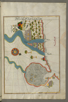
Map of the City of Alexandria
late 11th century AH/AD 17th century-early 12th century AH/AD 18th century (Ottoman)
W.658.302A
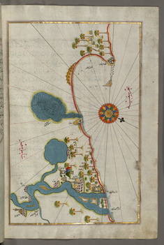
Map of the Coast of Alexandria Showing a Portion of the Town Itself
late 11th century AH/AD 17th century-early 12th century AH/AD 18th century (Ottoman)
W.658.300A
Map of the Egyptian Coast From Matruh East Towards Alexandria
late 11th century AH/AD 17th century-early 12th century AH/AD 18th century (Ottoman)
W.658.298B
Map of the Egyptian Coast From Salum East
late 11th century AH/AD 17th century-early 12th century AH/AD 18th century (Ottoman)
W.658.297B
Map of the Libyan Coast as Far as Salum
late 11th century AH/AD 17th century-early 12th century AH/AD 18th century (Ottoman)
W.658.296B
Map of the Libyan Coast Towards the Egyptian Border
late 11th century AH/AD 17th century-early 12th century AH/AD 18th century (Ottoman)
W.658.295B
Map of the Libyan Coast Towards the Egyptian Border
late 11th century AH/AD 17th century-early 12th century AH/AD 18th century (Ottoman)
W.658.294B
Map of the Libyan Coast as Far as Benghazi
late 11th century AH/AD 17th century-early 12th century AH/AD 18th century (Ottoman)
W.658.293A
Map of the Libyan Coast from Tripoli East Towards Egypt
late 11th century AH/AD 17th century-early 12th century AH/AD 18th century (Ottoman)
W.658.290A
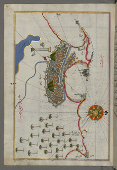
Map of the Fortress of Tripoli and the Surrounding Area
late 11th century AH/AD 17th century-early 12th century AH/AD 18th century (Ottoman)
W.658.289A
Map of the Coast of Tripoli
late 11th century AH/AD 17th century-early 12th century AH/AD 18th century (Ottoman)
W.658.286B
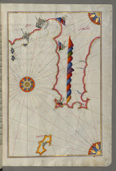
Map of the Tunisian Coast with the Fortress of Mahdiyah and the Island of Jarbah
late 11th century AH/AD 17th century-early 12th century AH/AD 18th century (Ottoman)
W.658.283B
Map of the Tunisian Coast with the Cities of Kelibia, Hammamet, Sousse, and Monastir
late 11th century AH/AD 17th century-early 12th century AH/AD 18th century (Ottoman)
W.658.281B