
Book on Navigation
(Manuscripts and Rare Books, Islamic World , Islamic Manuscripts)
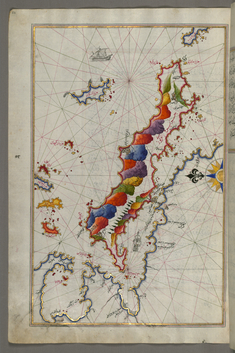
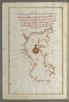
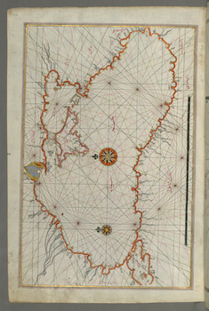
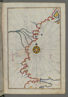
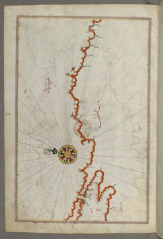
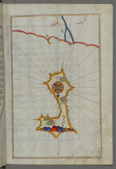
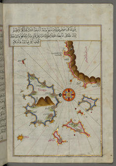
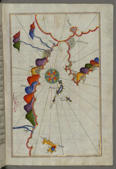
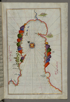
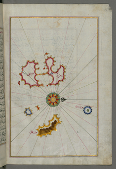
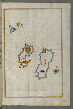
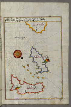
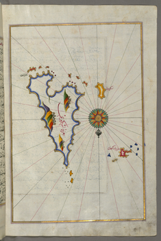
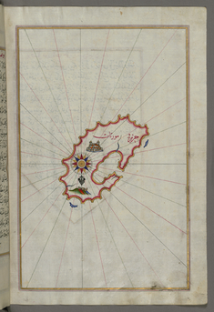
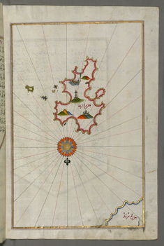
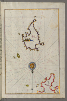
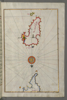
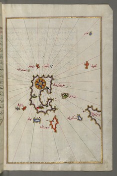
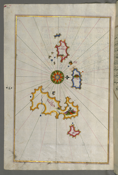
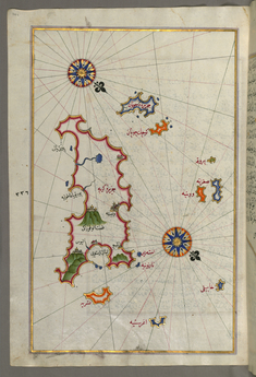
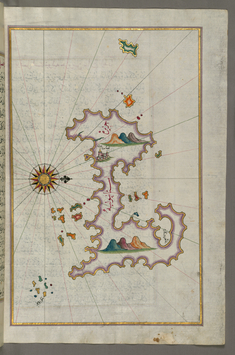
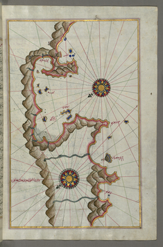
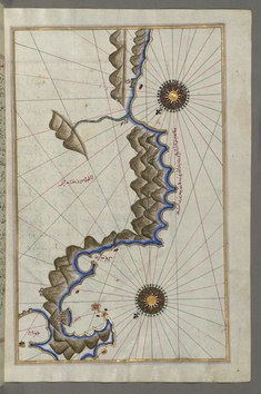
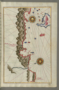
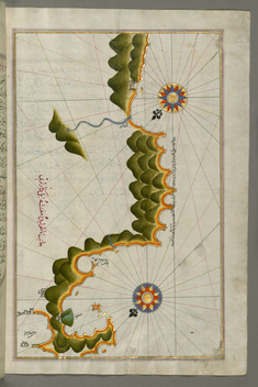
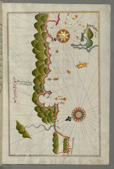
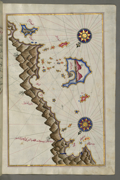
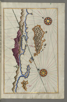
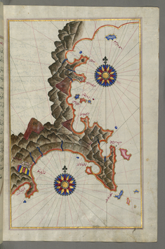
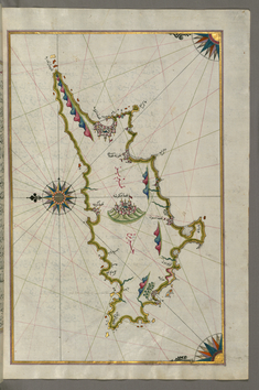
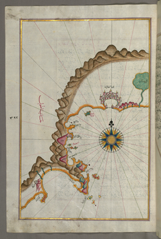
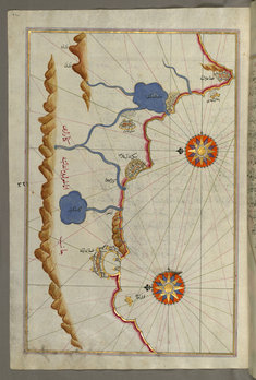
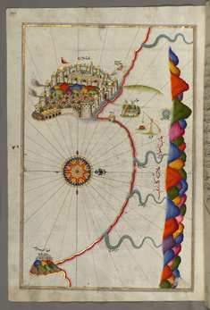
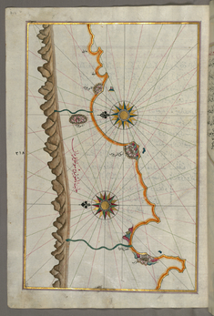
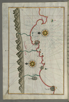
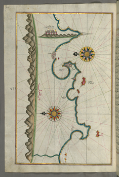
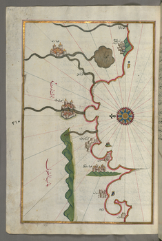
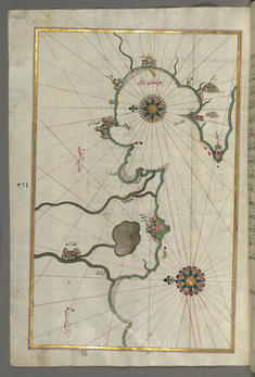
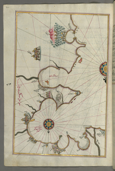
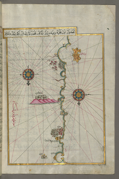
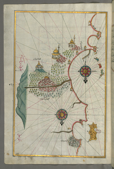
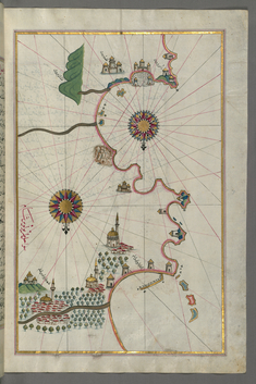
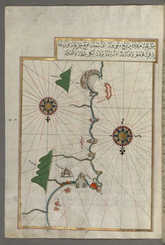
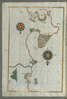
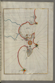
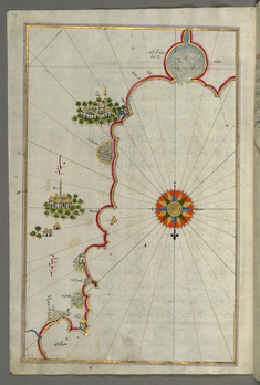
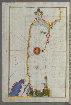
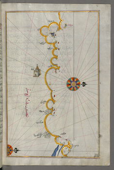
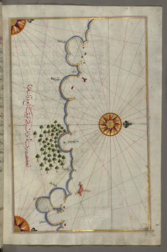
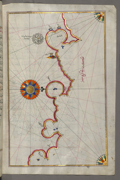
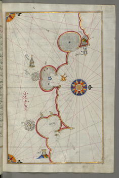
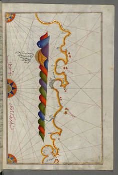
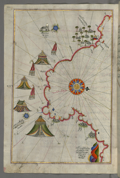
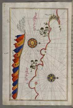
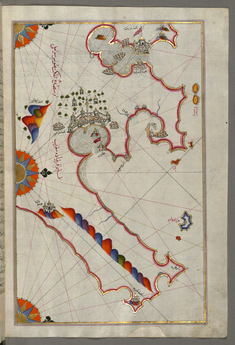
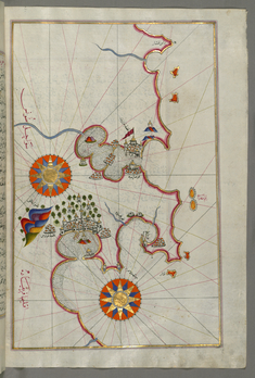
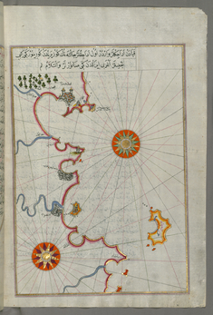
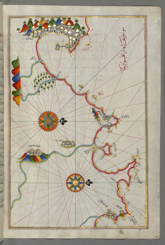
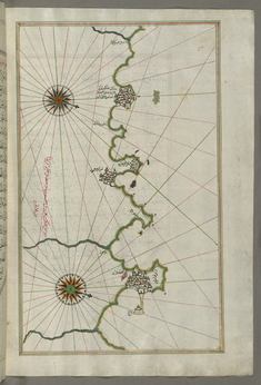
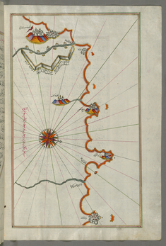
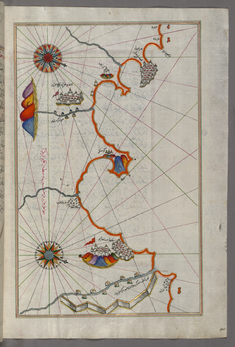
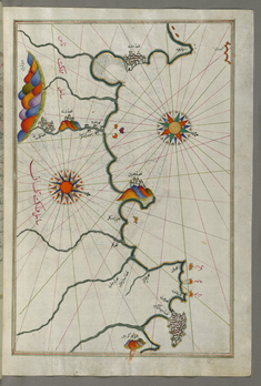
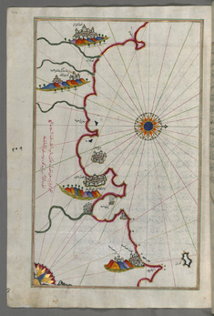
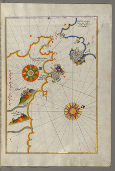
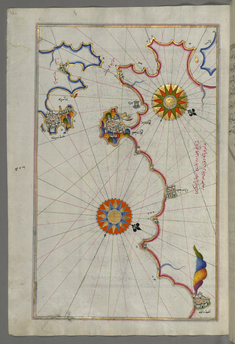
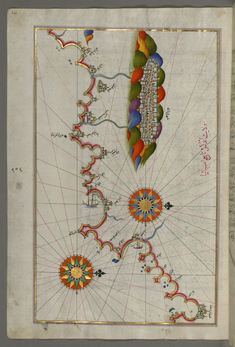
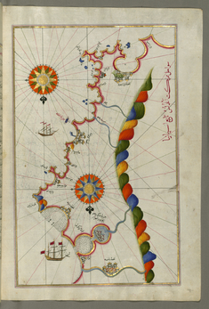
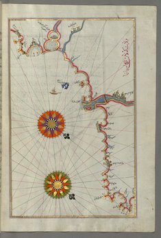
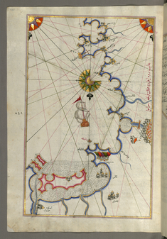
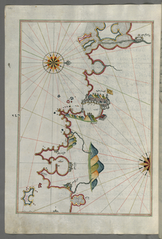
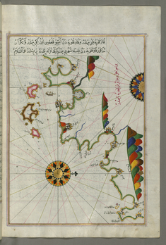
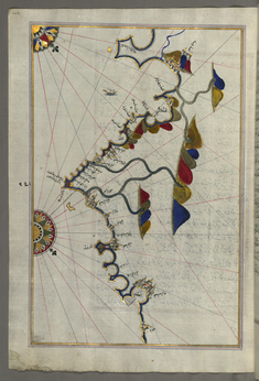
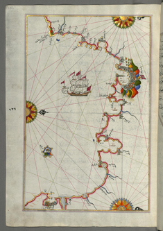
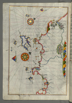
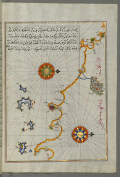
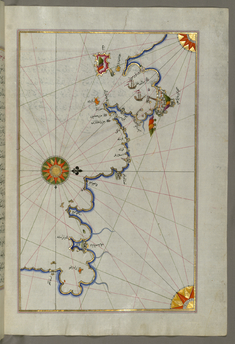
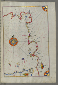
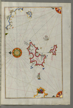
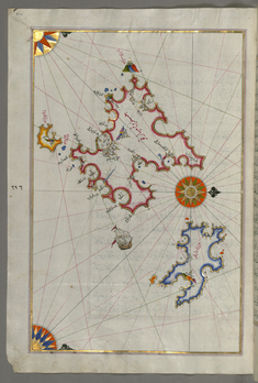
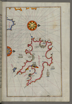
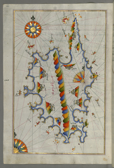
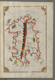
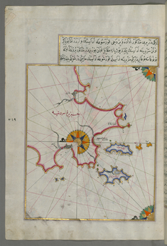
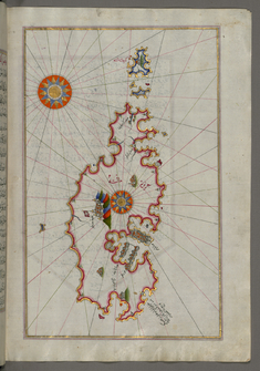
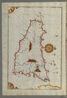
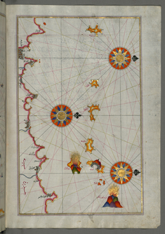
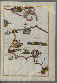
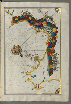
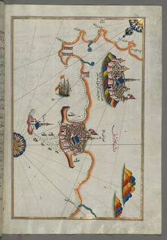
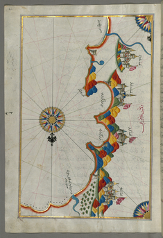
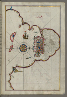
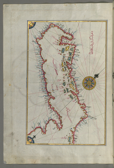
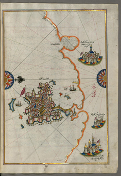
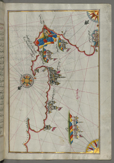
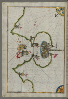
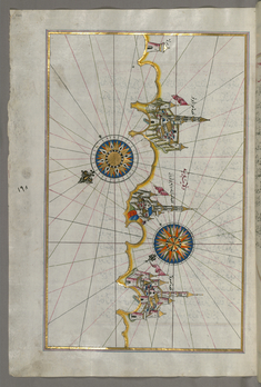
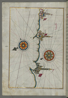
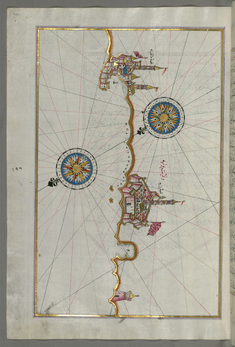
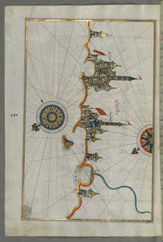
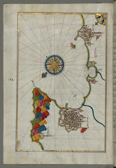
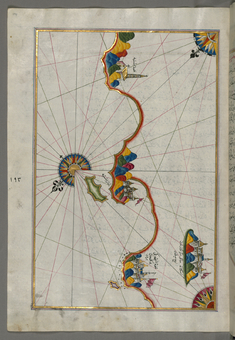
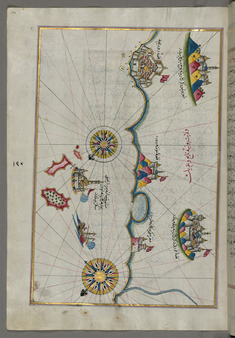
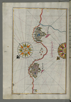
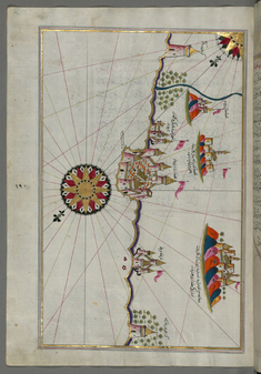
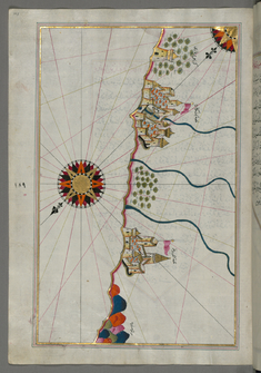
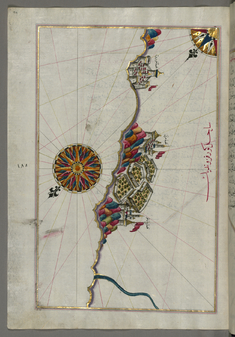
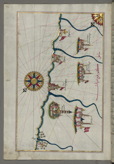
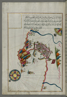
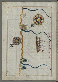
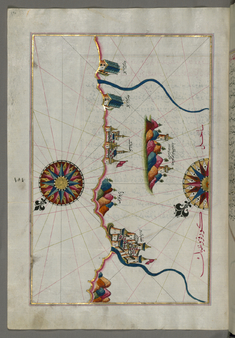
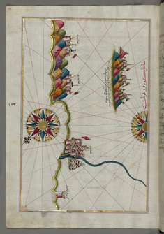
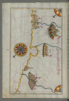
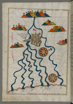
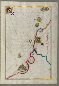
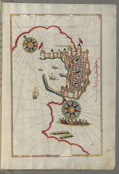
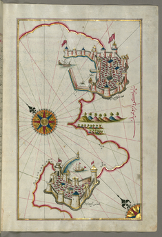
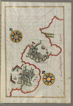
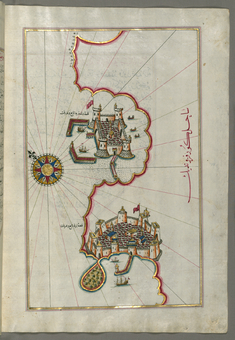
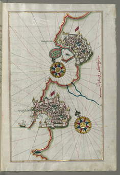
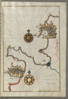
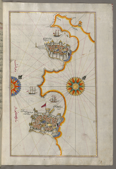
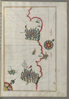
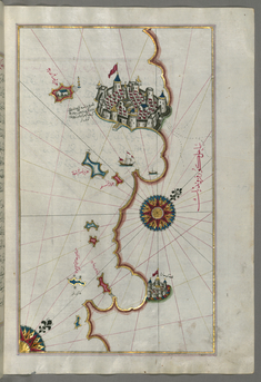
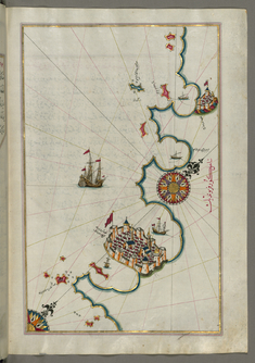
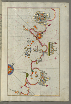
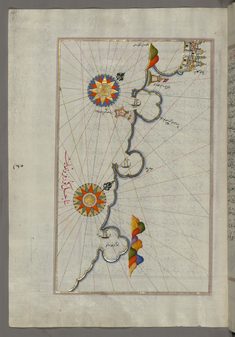
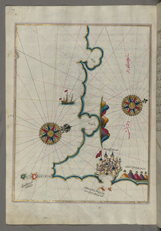
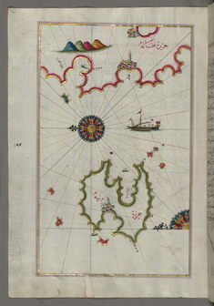
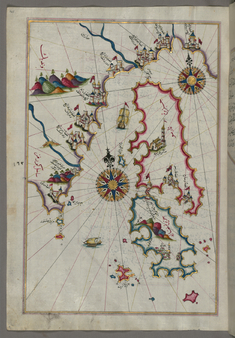
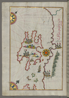
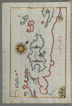
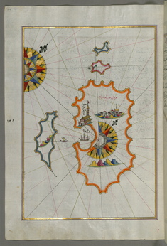
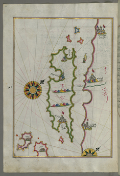
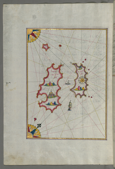
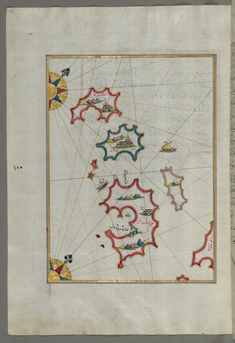
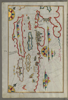
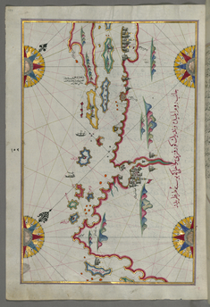
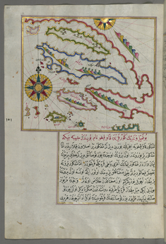
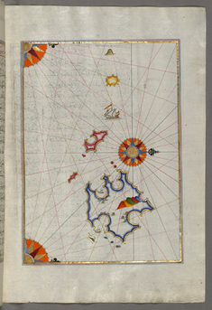
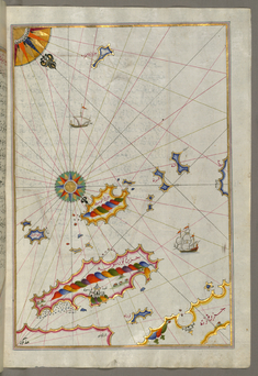
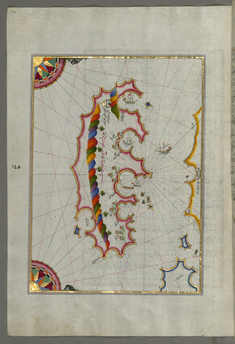
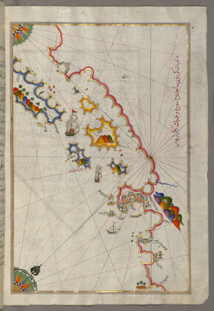
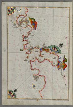
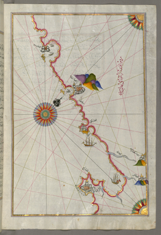
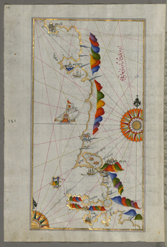
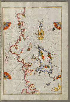
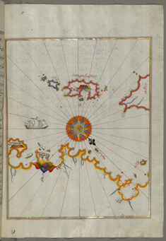
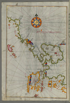
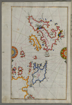
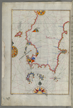
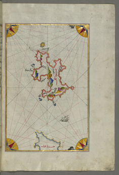
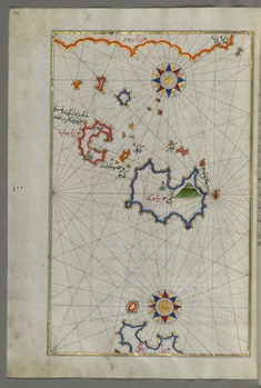
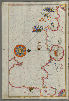
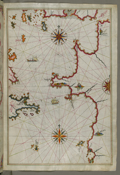
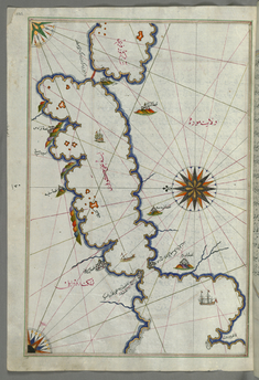
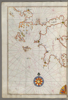
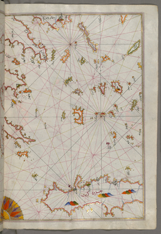
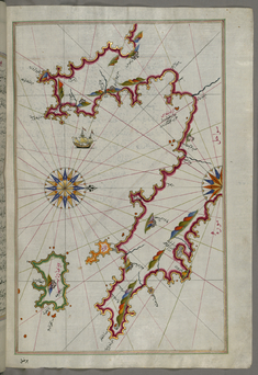
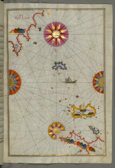
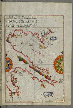
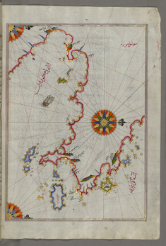
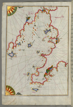
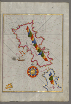
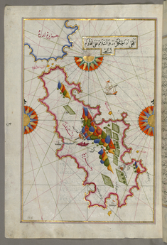
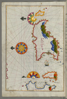
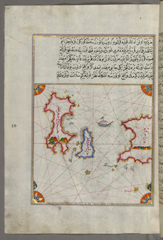
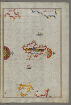
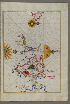
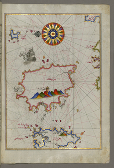
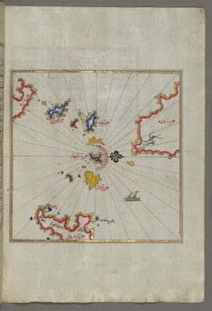
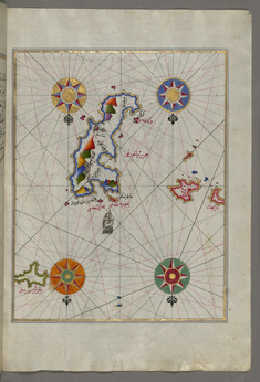
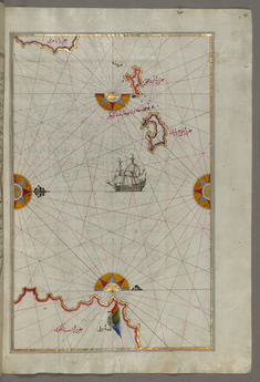
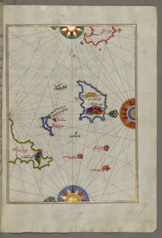
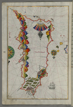
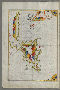
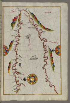
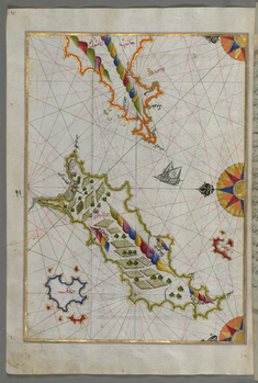
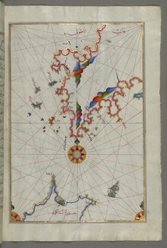
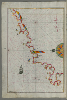
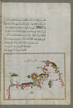
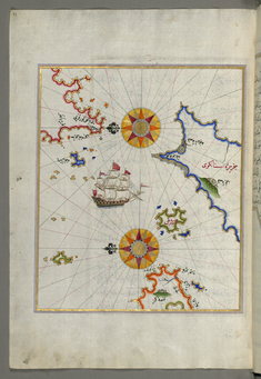
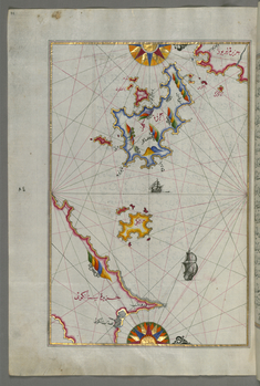
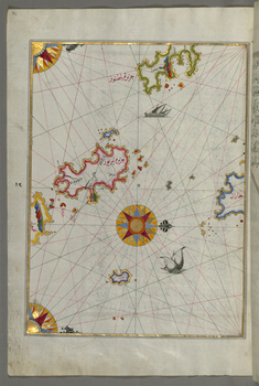
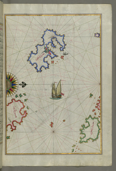
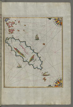
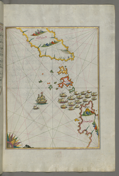
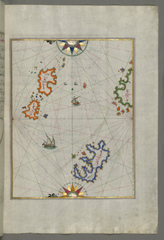
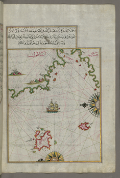
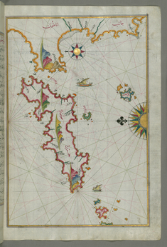
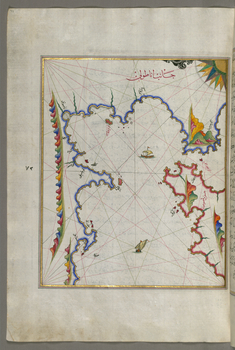
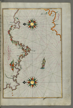
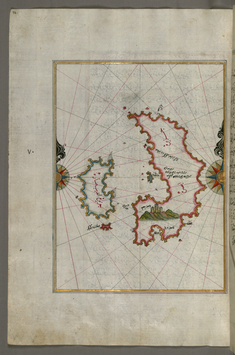
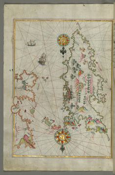
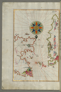
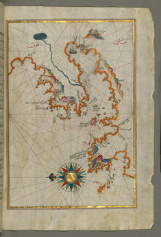
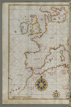
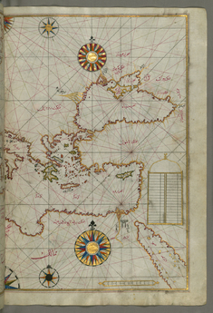
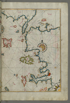
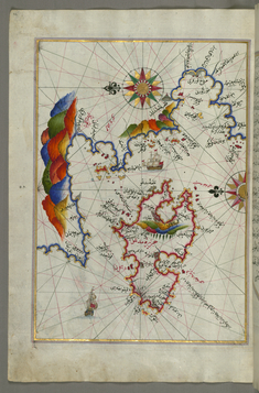
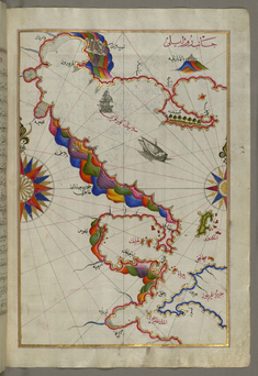
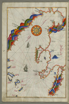
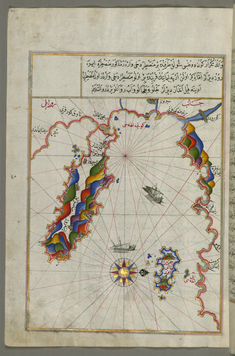
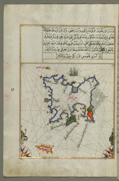
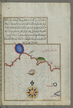
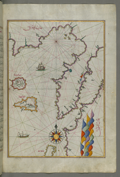
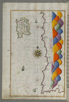
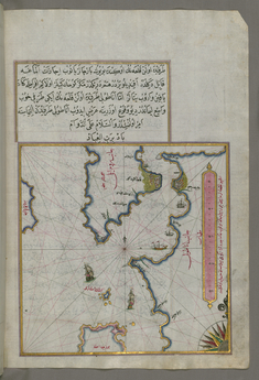
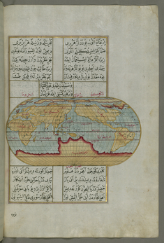
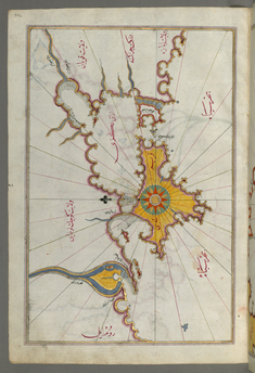
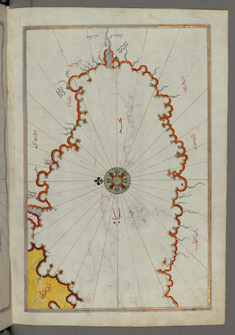
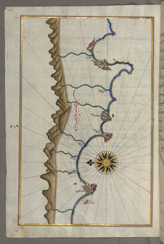
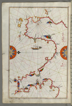
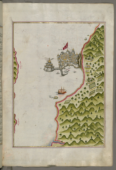
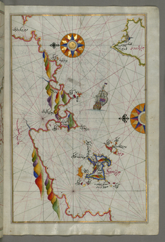
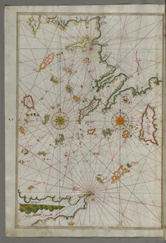
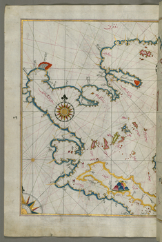
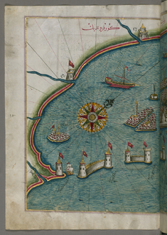
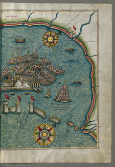
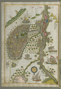
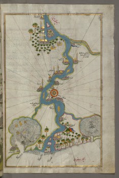
Originally composed in 932 AH/AD 1525 and dedicated to Sultan Süleyman I ("The Magnificent"), this great work by Piri Reis (d. 962 AH/AD 1555) on navigation was later revised and expanded. Walters manuscript W.658, made mostly in the late 11th century AH/AD 17th, is based on the later expanded version and has some 240 exquisitely executed maps and portolan charts. They include a world map (fol. 41a) with the outline of the Americas, as well as maps of coastlines (bays, capes, peninsulas), islands, mountains, and cities of the Mediterranean basin and the Black Sea. The work starts with the description of the coastline of Anatolia and the islands of the Aegean Sea, the Peloponnese peninsula, and the eastern and western coasts of the Adriatic Sea. It then proceeds to describe the western shores of Italy, southern France, Spain, North Africa, Palestine, Israel, Lebanon, Syria, western Anatolia, various islands north of Crete, the Sea of Marmara, Bosporus, and the Black Sea. It ends with a map of the shores of the Caspian Sea (fol. 374a).
Provenance
Provenance (from the French provenir, 'to come from/forth') is the chronology of the ownership, custody, or location of a historical object. Learn more about provenance at the Walters.
Ahmad Afandi [date and mode of acquisition unknown] [see folio 4a]; Ali Afandi [date and mode of acquisiton unknown] [see folio 4a]; Sayyid Ali Qapudan [date and mode of acquisition unknown] [see folio 1a]; Sultan Mahmud Khan [date and mode of acquistion unknown] [waqf seal and followed by a bequest statement (now erased), and the seal of the inspector of wakfs, Mustafá Tahir, see folio 4a]; Henry Walters, Baltimore [date and mode of acquisition unknown]; Walters Art Museum, 1931, by bequest.
Exhibitions
| 2015-2016 | Pearls on a String: Artists, Patrons, and Poets at the Great Islamic Courts. The Walters Art Museum, Baltimore; Asian Art Museum, San Francisco. |
| 2013-2014 | Egypt’s Mysterious Book of the Faiyum. The Walters Art Museum, Baltimore. |
| 2010 | Poetry and Prayer: Islamic Manuscripts from the Walters Art Museum. The Walters Art Museum, Baltimore. |
| 2007-2008 | Maps: Finding Our Place in the World. The Field Museum, Chicago; The Walters Art Museum, Baltimore. |
| 2001-2002 | Expanding World Views: A Millennium of Maps. The Walters Art Museum, Baltimore. |
Conservation
| Date | Description | Narrative |
|---|---|---|
| 9/12/2013 | Treatment | binding stabilized; examined for condition; examined for exhibition; media consolidation; repaired; stabilized |
Geographies
Turkey (Place of Origin)
Measurements
Folio H: 13 3/8 x W: 9 7/16 in. (34 x 24 cm); H open in cradle at 0°: 18 1/4 x 14 1/4 x 8 1/2 in. (46.36 x 36.2 x 21.59 cm); H open in cradle at 10°: 18 1/4 x 13 3/4 x 10 in. (46.36 x 34.93 x 25.4 cm)
Credit Line
Acquired by Henry Walters
Location in Museum
Not on view
Accession Number
In libraries, galleries, museums, and archives, an accession number is a unique identifier assigned to each object in the collection.
In libraries, galleries, museums, and archives, an accession number is a unique identifier assigned to each object in the collection.
W.658
Do you have additional information?
Related Objects
Map of the Caspian Sea
Map of the Black Sea Coastline
Map of the Sea of Marmara, Bosporus Strait and the Black Sea
Map of the Coast of the Black Sea from Istanbul to Geresun
Map of the Island of Mir 'Ali
Map of the Island of Marmara in the Sea of Marmara
Leaf from Book on Navigation
Map of Part of the Coastline of the Sea of Marmara, with the Town of Kavak
Leaf from Book on Navigation
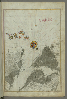
Map of Aloneses and Unidentified Islands
Leaf from Book on Navigation
Map of Skyros Island
Map of Keos Island
Map of Kythnos Island
Map of Serofos (Koyunluga) Island
Leaf from Book on Navigation
Map of Melos Island

Map of the Islands Folegandros and Melos
Map of the Islands Folegandros and Ios
Map of Two Islands: Santorini and Thera in the Aegean Sea, North of Crete
Map of the Island of Anafi, East of Thera
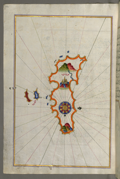
Map of the Island of Crete
Map Fragment of the Island of Crete
Map of the Islands of Karpathos and Kasos
Map of the Istanbul Island
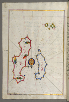
Map of Unidentified Islands Off the Southern Anatolian Coast
Map of Unidentified Islands Off the Southern Anatolian Coast
Map of Unidentified Islands Off the Southern Anatolian Coast
Map of Unidentified Islands Off the Southern Anatolian Coast
Map of Unidentified Islands Off the Southern Anatolian Coast
Map of Unidentified Islands Off the Southern Anatolian Coast
Map of the Islands Off the Shores of Finike
Map of the Anatolian Coast East of Finike
Map of the Island of Cyprus
Map of the Anatolian Coast From Alanya to Andalye
Map of the Anatolian Coast from Alanya to Andalye
Map of the Fortress of Alanya
Map of the Anatolian Coast Around Anamur
Map of the Anatolian Coast From Silfke to Anamur
Map of the Anatolian Coast with the City of Silifke
Map of the Anatolian Coast and the Cities Adana and Tarsus
Map of the Anatolian Coast, the City of Iskenderun as Afar as the Shores of Adana
Map of the Eastern Mediterranean Coast and the Cities of Latakia and Antakya
Map of the Eastern Mediterranean Coast Beginning with the Island of Khatun as Far as Latakia
Map of the City of Tripoli
Map of the Eastern Mediterranean Coast and City of Tripoli
Map of the Eastern Mediterranean Coast as Far as the City of Beirut
Map of the Eastern Mediterranean Coast with the City of Tyre
Map of the Eastern Mediterranean Coastline with the Cities of Jaffa and Caesarea
Map of the "Syrian Coast" and the Cities: Gaza and Ramlah
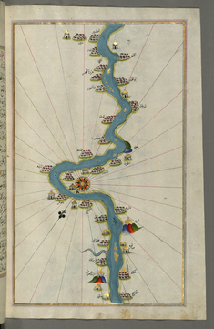
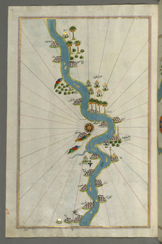
Map of the Oases and Villages Along the River Nile as Far as Sidi Musá
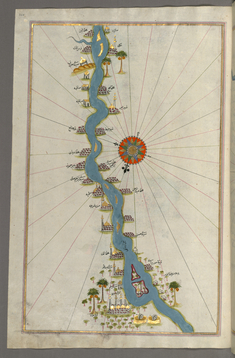
Map of Oases and Villages Along the River Nile as Far as Sidi Musá
Map of an Unmarked Part of the Egyptian Coastline
Map of the City of Damietta on the Egyptian Coast
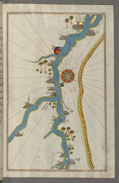
Map of Towns and Oases Along the River Nile Beginning with Bulaq
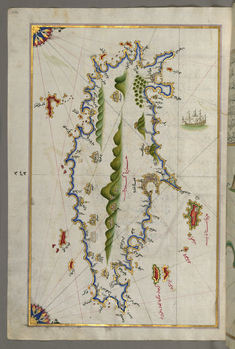
Map of the River Nile with Various Oases on Each Side
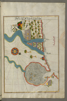
Map of the River Nile Estuary with the Cities of Rashid and Burullus on Each Side
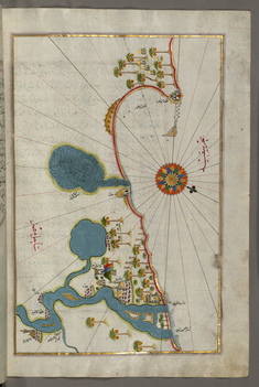
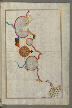
Map of the Egyptian Coast From Alexandria as Far as the City of Rashid
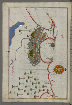
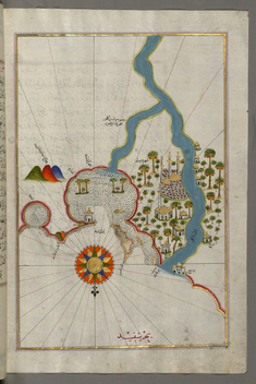
Map of the City of Alexandria
Map of the Coast of Alexandria Showing a Portion of the Town Itself
Map of the Egyptian Coast From Matruh East Towards Alexandria
Map of the Egyptian Coast From Salum East
Map of the Libyan Coast as Far as Salum
Map of the Libyan Coast Towards the Egyptian Border
Map of the Libyan Coast Towards the Egyptian Border
Map of the Libyan Coast as Far as Benghazi
Map of the Libyan Coast from Tripoli East Towards Egypt
Map of the Fortress of Tripoli and the Surrounding Area
Map of the Coast of Tripoli
Map of the Tunisian Coast with the Fortress of Mahdiyah and the Island of Jarbah
Map of the Tunisian Coast with the Cities of Kelibia, Hammamet, Sousse, and Monastir
Map of the Tunisian Coast with the Ports of Bizerte and Tunis as Far as Kelibia
Map of the Coast of Tunisia with the Ports of Bizerte and Tunis
Map of the Algerian and Tunisian Coast From Annaba to Tabarka
Map of the Algerian Coast From the Port of Bejaia as Far as Annaba with the City of Constantine
Map of the Algerian Coast around Algiers
Map of the Algerian Coast Around Mostaganem
Map of the Algerian Coast Around Oran and Mostaganem
Map of the Moroccan and Algerian Coast From Melilla and Northwest of Tlemcen
Map of the Moroccan Coast From the City of Tetouan West
Map of Southern Spain and Morocco with the Cities of Gibraltar, Ceuta and Tetouan
Map of the Strait of Gibraltar with the Cities of Gibraltar and Ceuta
Map of the Coast of Andalusia with the City of Grenada
Map of the Coast of Andalusia from Valencia to Cartagena
Map of the Coast of Catalonia with the Ports of Barcellona and Tarragona
Map of the Coast Around Narbonne
Map of the French Coast Around Marseille
Map of the French Coast From Nice as Far as Toulon
Map of the French Coast From the Italian Border as Far as Nice
Map of the Western Italian Coast from Pisa to the French Border, Including the Towns of Genoa and Savona
Map of the Western Italian Coast as Far as the City of Pisa
Map of the Western Italian Coast as Far as the City of Rome
Map of the Western Italian Coast as Far as Naples and the Island of Ischia
Map of the Straits of Messina and the Western Italian Coast
Map of Two Islands Off Majorca: Ibiza and Formentera
Map of the Islands of Mojorca and Minorca
Map of the Island of Minorca
Map of the Island of Corsica
Map of the Island of Sardinia
Map of Two Small Islands Off the Coast of Sardinia
Map of the Island of Malta
Map of the Island of Sicily
Map of the Northern Coast of Sicily From Milazzo to Palermo
Map of the Southern Part of the Calabrian Peninsula and the Straits of Messina
Map of the Calabrian Coast From Catanzaro to Siquillace
Map of the Eastern Coast of Calabria with the Towns of Crotone and Catanzaro
Map of the Eastern Coast of Calabria Around Rossano
Map of the City of Taranto in the Province of Puglia
Map of the Coastlines and the Islands of the Adriatic Sea
Map of the Towns of Gallipoli and Nardo on the Italian Coast
Map of the Italian Coast from Lecce to Gallipoli
Map of the Port of Brindisi
Map of the Italian Coast Around Monopoli, South of Bari
Map of the Town of Bari and the Surrounding Area
Map of the Italian Coast From Trani as Far as Molfetta
Map of the Italian Coastline From Barletta to Trani
Map of the Coastline from Mafredonia as Far as Barletta on the Italian Coast
Map of the Italian Coast Around Peschici North of Mafredonia
Map of the Italian Coast Between Termoli and Peschici
Map of the Towns Vasto and Termoli on the Italian Coast
Map of the Town of Lanciano and the Surrounding Fortresses
Map of the Italian Coast South of Ancona as Far as the Town of Pescara
Map of the Italian Coastline South of Ancona Including Tronto (?)
Map of the Fortresses and Towns South of Ancona, Including Loreto
Map of the Fortress of Ancona and the Surrounding Area
Map of the Town of Urbino and the Surrounding Area
Map of the Italian Coastline from Pesaro South
Map of the Italian Coastline From Rimini South Towards Pesaro
Map of the Italian Coastline with the Cities of Ravenna and Cesena
Map of the City of Ferrara with the Six Rivers Flowing into the Gulf of Venice
Map of the Coastline From Marano to Caorle, Province of Venice
Map of the Fortress of Trieste
Map of the Coastline from Muggia to Trieste
Map of the Coastline Between the Cities of Koper and Muggia
Map of the Coastline From Izola as Far as Koper
Map of the Coastline from Piran as Far as Izola
Map of the Coastline from Umag as Far as Piran
Map of the Coastline From Novi Grad as Far as Umag
Map of the Coastline From Porec as Far as Novi Grad
Map of the Coastline From Rovinj as Far as the Fortress of Porec
Map of the Coastline from Rovinj North
Map of the Coastline from Pula to Rovinj
Map of the Coast from Medulin as Far as Pula
Map of the Coast North of the Medulin Fortress
Map of the Island of Unije South of Lošinj Island
Map of Cres, Lošinj and Unije Islands
Map of the Island of Krk
Map of the Islands of Pag and Rab
Map of Premuda Island West Off the Pag Island
Map of the Island of Rab
Map of Two Unidentified Islands in the Vicinity of Pag Island.
Map of Small Islands Northwest of the Pag Island
Map of the Coastline and the Islands Off Zadar
Map of the Coastline and the Islands Between Šibenik and Zadar
Map of a Group of Islands North of Korcula, Probably Hvar and Brac
Map of Two Unnamed Island Between Dubrovnik and Split
Map of the Dalmatian Islands: Korcula and Lastovo Off the Coast Between Dubrovnik and Split
Map of the Island of Mljet Off Dubrovnik
Map of the Adriatic Coastline from Dubrovnik North
Map of the Adriatic Coast from Budva to Dubrovnik
Map of the Adriatic Coast from Drac North of Karaburun as Far as Budva
Map of the Adriatic Coast Around Karaburun and Vlora
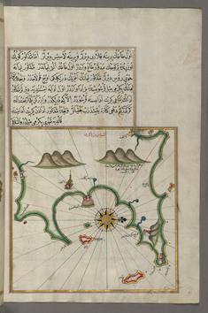
Map of the Islands of Corfu and Paxi
Map of the Area Between Corfu and Paxi Islands
Map of the Western Coast of Greece From the Island of Levcas Going North as Far as Paxi Island
Map of the Islands of Kefalonia, Ithaca, and Aya Mavra Off the Western Coast of Greece
Map of the Eastern Part of the Peloponnese Peninsula
Map of Telos Island North of Chalkis Island in the Eastern Aegean Sea
Map of Chalkis Island Off Rhodes Island
Leaf from Book on Navigation
Leaf from Book on Navigation
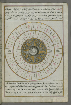
Western Hemisphere Within a Windrose
Map of the Bay of Corinth
Map of the Western Part of the Peloponnese Peninsula Opposite the Zakynthos Island
Leaf from Book on Navigation
Map of Saronikos Bay
Map of the Islands of Zakynthos, Kefalonia and Lefkada in the Ionian Sea
Map of the Cyclades Islands Between the Peloponnese Peninsula and Crete
Map of the Peloponnese Peninsula with the Island of Kythira and the Lakonikos Bay
Map of the Area Between the Peloponnese Peninsula and the Island of Crete
Map of Argolikos Bay and Peloponnese Peninsula
Map of Argolikos Bay
Map of the Bay of Saronikos (Atene) with the City of Athens
Map of the Island of Andros in the Northern Aegean Sea
Map of Tinos Island in the Aegean Sea
Map of Mykonos Island in the Aegean Sea
Map of the Islands of Delos and Rineia West of Mykonos Island in the Aegean Sea
Map of the Island of Syros in the Aegean Sea
Map of the Island of Paros in the Aegean Sea
Map of the Island of Naxos in the Southeastern Aegean Sea
Map of Small Islands in the Region of Naxos and Amorgos in the Southeastern Aegean Sea
Map of the Island of Amorgos in the Southeastern Aegean Sea
Map of Two Small Islands Between Amorgos and Cos in the Eastern Aegean Sea
Map of Nisyros Island South of Cos Island in the Eastern Aegean Sea
Map of Rhodes Island
Map of Syme Island North-west of Rhodes Island
Map of the Bay of Kerme East of Cos Island
Map of the Island of Cos Off the Anatolian Coast
Map of the Anatolian Coast Facing the Island of Cos
Map of the Anatolian Coast Along the Kerme Bay
Map of the Anatolian Coast and the Small Kara Island
Map of the Island of Cos Facing the Anatolian Mainland
Map of the Island of Kalimnos
Map of the Island of Leros
Map of the Island of Patmos
Map of the Island of Ikaria in the Eastern Aegean Sea
Map of the Area Between the Islands of Ikaria and Samos
Map of Several Islands of the Eastern Aegean Sea Including: Leros and Patmos
Map of Two Small Islands Off the Coast of Anatolia
Map of the Island of Samos
Map of the Anatolian Coast Facing the Island of Samos
Map of the Anatolian Coast Facing the Island of Samos
Map of the the Island of Psara West of Chios
Detailed Map of Sakiz Island with its Fortress and Other Topographical Features
Map of Chios Island Facing Kysos Fortress on the Anatolian Side
Map of the Anatolian Coast Around the Bay of Izmir
Map of Western Europe and North Africa
Map of the Eastern Mediterranean, Aegean and the Black Sea
Map of the Sea of Marmara and the Islands of the Eastern Aegean Sea from Semendrek to Chios
Map of the Island of Midilli in the Northeastern Aegean Sea
Leaf from Book on Navigation
Map of the Bay of Salonica and the Western Coastline
Map of the Bay of Salonica
Map of the Area West of the Island of Thasos and the Ayion Oros Peninsula
Map of the Island of Lemnos
Map with Part of the European Coastline with the Islands of Semendrek and Imroz in the Aegean Sea
Map of the Islands of Semendrek and Imroz in the Aegean Sea
Map of the Island of Bozjah (Tenedos) Off the Coast of Anatolia
Map of the Upper Aegean Sea with the Islands of Imbros and Bozca
Oval Map of the World
Illuminated Headpiece and Frame
Leaf from Book on Navigation
Map of the Crimea, the Sea of Azov, and the Mouth of the Dnieper
Leaf from Book on Navigation
Leaf from Book on Navigation
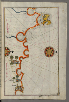
Map of the Coastline of the Black Sea
Leaf from Book on Navigation
Leaf from Book on Navigation
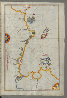
Map of the Anatolian Coast as Far as Alanya
Leaf from Book on Navigation
Leaf from Book on Navigation
Leaf from Book on Navigation
Leaf from Book on Navigation
Leaf from Book on Navigation
Leaf from Book on Navigation
Leaf from Book on Navigation
Leaf from Book on Navigation
Leaf from Book on Navigation
Leaf from Book on Navigation
Leaf from Book on Navigation
Leaf from Book on Navigation
Leaf from Book on Navigation
Leaf from Book on Navigation
Leaf from Book on Navigation
Map of Messiniakos Bay
Map of the Methana Fortress in the Saronikos Bay
Map of the Northeastern Tip of Rhodes Island Facing the Anatolian Coast with the Island of Syme
Map of the Islands of the Aegean Sea Including Chios, Cos, Rhodes and Crete
Map of the Coastline of the Western Aegean Sea as Far South as the Island of Euboea
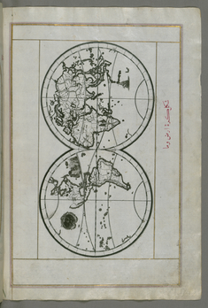
World Map in a Double Hemisphere
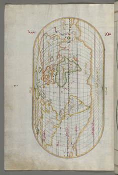
Oval World Map

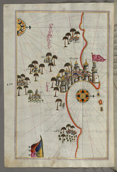
Map of the City of Istanbul, from Book on Navigation by Piri Reis
Map of the Algerian Coast From Algiers to Bejaia
Map of the Western Part of the City of Venice
Map of the Eastern Part of the City of Venice
Map of the River Nile From Its Estuary South