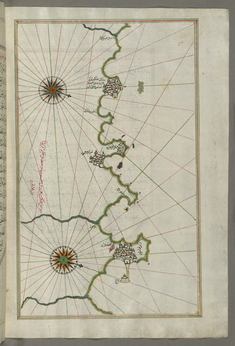
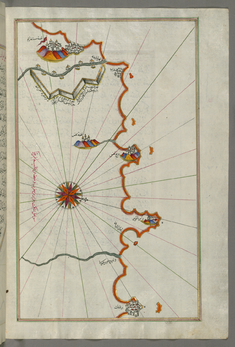
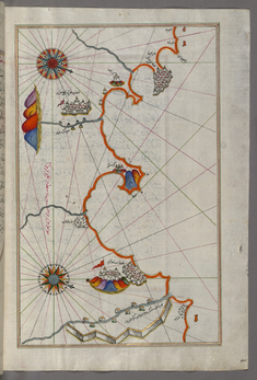
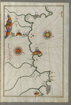
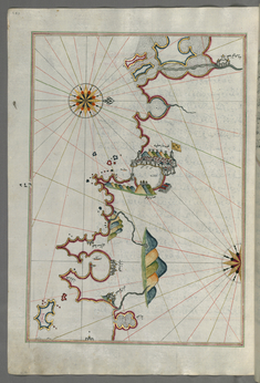
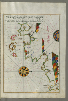
Piri Reis
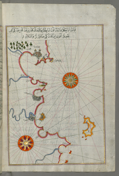
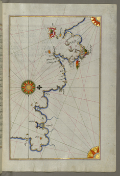
Map of the Tunisian Coast with the Ports of Bizerte and Tunis as Far as Kelibia
late 11th century AH/AD 17th century-early 12th century AH/AD 18th century (Ottoman)
W.658.279B
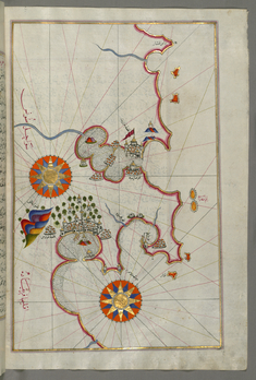
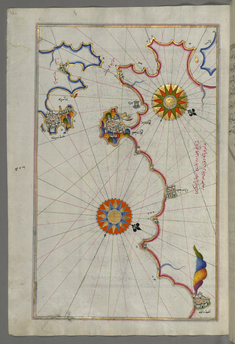
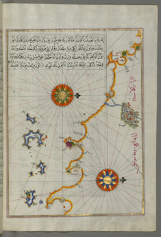
Map of the Coast of Tunisia with the Ports of Bizerte and Tunis
late 11th century AH/AD 17th century-early 12th century AH/AD 18th century (Ottoman)
W.658.277B
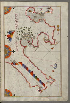
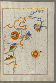
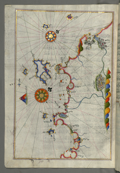
Map of the Algerian and Tunisian Coast From Annaba to Tabarka
late 11th century AH/AD 17th century-early 12th century AH/AD 18th century (Ottoman)
W.658.276B
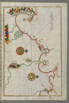
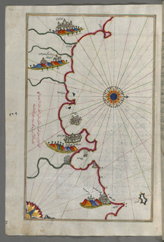
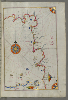
Map of the Algerian Coast From the Port of Bejaia as Far as Annaba with the City of Constantine
late 11th century AH/AD 17th century-early 12th century AH/AD 18th century (Ottoman)
W.658.274B
Map of the Algerian Coast around Algiers
late 11th century AH/AD 17th century-early 12th century AH/AD 18th century (Ottoman)
W.658.270B
Map of the Algerian Coast Around Mostaganem
late 11th century AH/AD 17th century-early 12th century AH/AD 18th century (Ottoman)
W.658.269B
Map of the Algerian Coast Around Oran and Mostaganem
late 11th century AH/AD 17th century-early 12th century AH/AD 18th century (Ottoman)
W.658.268B
Map of the Moroccan and Algerian Coast From Melilla and Northwest of Tlemcen
late 11th century AH/AD 17th century-early 12th century AH/AD 18th century (Ottoman)
W.658.267B
Map of the Moroccan Coast From the City of Tetouan West
late 11th century AH/AD 17th century-early 12th century AH/AD 18th century (Ottoman)
W.658.266A
Map of Southern Spain and Morocco with the Cities of Gibraltar, Ceuta and Tetouan
late 11th century AH/AD 17th century-early 12th century AH/AD 18th century (Ottoman)
W.658.264B
Map of the Strait of Gibraltar with the Cities of Gibraltar and Ceuta
late 11th century AH/AD 17th century-early 12th century AH/AD 18th century (Ottoman)
W.658.263A
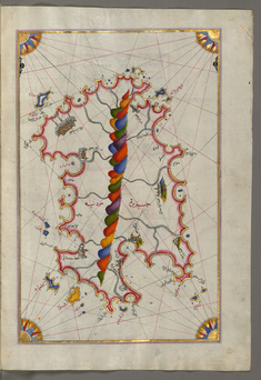
Leaf from Book on Navigation
late 11th century AH/AD 17th century-early 12th century AH/AD 18th century (Ottoman)
W.658.261B
Map of the Coast of Andalusia with the City of Grenada
late 11th century AH/AD 17th century-early 12th century AH/AD 18th century (Ottoman)
W.658.261A
Map of the Coast of Andalusia from Valencia to Cartagena
late 11th century AH/AD 17th century-early 12th century AH/AD 18th century (Ottoman)
W.658.259B
Map of the Coast of Catalonia with the Ports of Barcellona and Tarragona
late 11th century AH/AD 17th century-early 12th century AH/AD 18th century (Ottoman)
W.658.257B
Map of the Coast Around Narbonne
late 11th century AH/AD 17th century-early 12th century AH/AD 18th century (Ottoman)
W.658.255A
Map of the French Coast Around Marseille
late 11th century AH/AD 17th century-early 12th century AH/AD 18th century (Ottoman)
W.658.253A
Map of the French Coast From Nice as Far as Toulon
late 11th century AH/AD 17th century-early 12th century AH/AD 18th century (Ottoman)
W.658.250B
Map of the French Coast From the Italian Border as Far as Nice
late 11th century AH/AD 17th century-early 12th century AH/AD 18th century (Ottoman)
W.658.248A
Map of the Western Italian Coast from Pisa to the French Border, Including the Towns of Genoa and Savona
late 11th century AH/AD 17th century-early 12th century AH/AD 18th century (Ottoman)
W.658.246A
Map of the Western Italian Coast as Far as the City of Pisa
late 11th century AH/AD 17th century-early 12th century AH/AD 18th century (Ottoman)
W.658.244A
Map of the Western Italian Coast as Far as the City of Rome
late 11th century AH/AD 17th century-early 12th century AH/AD 18th century (Ottoman)
W.658.240B
Map of the Western Italian Coast as Far as Naples and the Island of Ischia
late 11th century AH/AD 17th century-early 12th century AH/AD 18th century (Ottoman)
W.658.238B
Map of the Straits of Messina and the Western Italian Coast
late 11th century AH/AD 17th century-early 12th century AH/AD 18th century (Ottoman)
W.658.236B
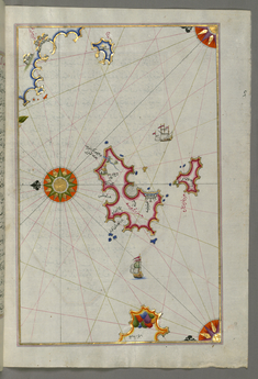
Map of Two Islands Off Majorca: Ibiza and Formentera
late 11th century AH/AD 17th century-early 12th century AH/AD 18th century (Ottoman)
W.658.234B
Map of the Islands of Mojorca and Minorca
late 11th century AH/AD 17th century-early 12th century AH/AD 18th century (Ottoman)
W.658.233A
Map of the Island of Minorca
late 11th century AH/AD 17th century-early 12th century AH/AD 18th century (Ottoman)
W.658.230B
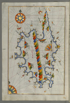
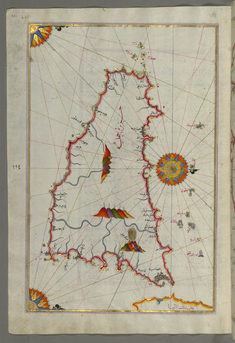
Map of the Island of Corsica
late 11th century AH/AD 17th century-early 12th century AH/AD 18th century (Ottoman)
W.658.229A
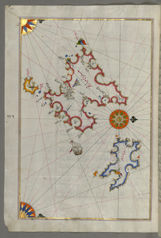
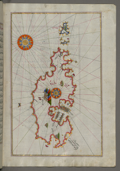
Map of the Island of Sardinia
late 11th century AH/AD 17th century-early 12th century AH/AD 18th century (Ottoman)
W.658.226B
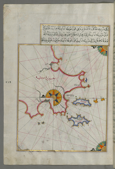
Map of Two Small Islands Off the Coast of Sardinia
late 11th century AH/AD 17th century-early 12th century AH/AD 18th century (Ottoman)
W.658.226A
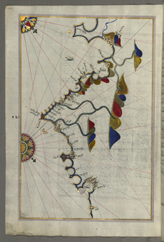
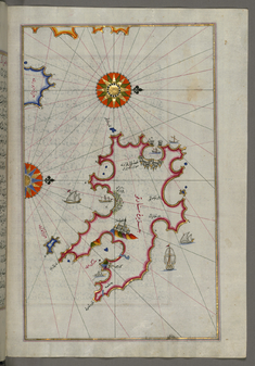
Map of the Island of Malta
late 11th century AH/AD 17th century-early 12th century AH/AD 18th century (Ottoman)
W.658.222B
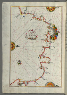
Map of the Island of Sicily
late 11th century AH/AD 17th century-early 12th century AH/AD 18th century (Ottoman)
W.658.221A