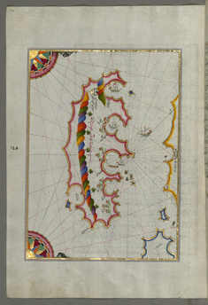
Piri Reis
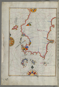
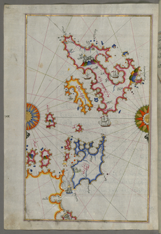
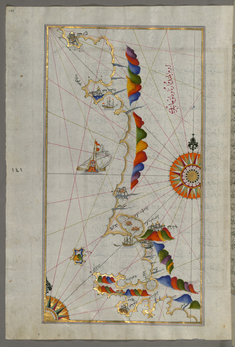
Map of the Eastern Part of the Peloponnese Peninsula
late 11th century AH/AD 17th century-early 12th century AH/AD 18th century (Ottoman)
W.658.134A
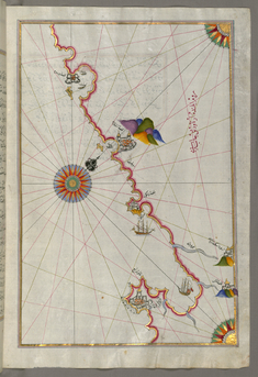
Leaf from Book on Navigation
late 11th century AH/AD 17th century-early 12th century AH/AD 18th century (Ottoman)
W.658.134B
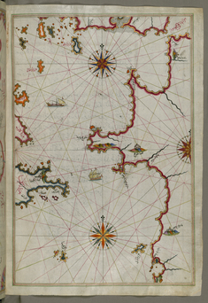
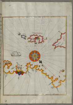
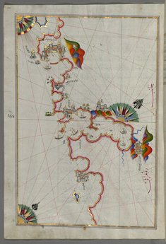
Map of the Western Part of the Peloponnese Peninsula Opposite the Zakynthos Island
late 11th century AH/AD 17th century-early 12th century AH/AD 18th century (Ottoman)
W.658.136B
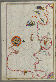
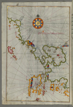
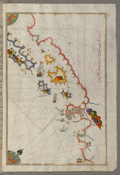
Map of the Bay of Corinth
late 11th century AH/AD 17th century-early 12th century AH/AD 18th century (Ottoman)
W.658.137A
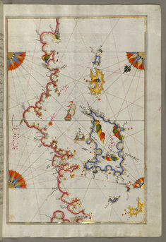
Map of the Islands of Kefalonia, Ithaca, and Aya Mavra Off the Western Coast of Greece
late 11th century AH/AD 17th century-early 12th century AH/AD 18th century (Ottoman)
W.658.139A
Map of the Western Coast of Greece From the Island of Levcas Going North as Far as Paxi Island
late 11th century AH/AD 17th century-early 12th century AH/AD 18th century (Ottoman)
W.658.141A
Map of the Area Between Corfu and Paxi Islands
late 11th century AH/AD 17th century-early 12th century AH/AD 18th century (Ottoman)
W.658.142B
Map of the Islands of Corfu and Paxi
late 11th century AH/AD 17th century-early 12th century AH/AD 18th century (Ottoman)
W.658.145B
Map of the Adriatic Coast Around Karaburun and Vlora
late 11th century AH/AD 17th century-early 12th century AH/AD 18th century (Ottoman)
W.658.147A
Map of the Adriatic Coast from Drac North of Karaburun as Far as Budva
late 11th century AH/AD 17th century-early 12th century AH/AD 18th century (Ottoman)
W.658.148B
Map of the Adriatic Coast from Budva to Dubrovnik
late 11th century AH/AD 17th century-early 12th century AH/AD 18th century (Ottoman)
W.658.150A
Map of the Adriatic Coastline from Dubrovnik North
late 11th century AH/AD 17th century-early 12th century AH/AD 18th century (Ottoman)
W.658.151B
Map of the Island of Mljet Off Dubrovnik
late 11th century AH/AD 17th century-early 12th century AH/AD 18th century (Ottoman)
W.658.153A