Piri Reis
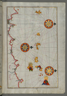
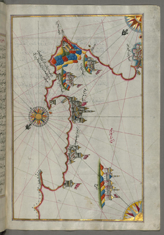
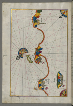
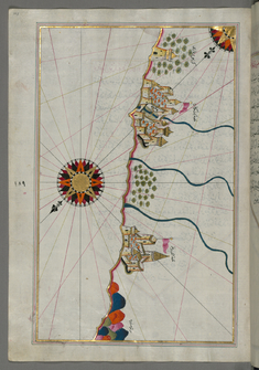
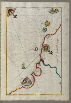
Map of the Northern Coast of Sicily From Milazzo to Palermo
late 11th century AH/AD 17th century-early 12th century AH/AD 18th century (Ottoman)
W.658.220B
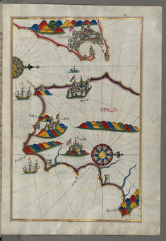
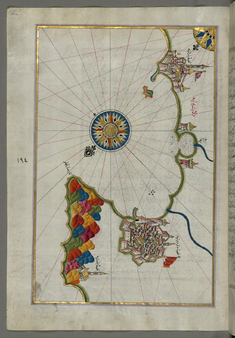
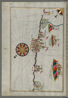
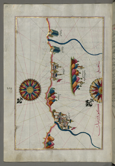
Map of the Southern Part of the Calabrian Peninsula and the Straits of Messina
late 11th century AH/AD 17th century-early 12th century AH/AD 18th century (Ottoman)
W.658.213B
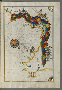
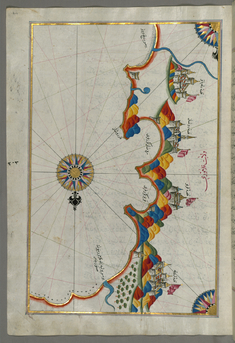
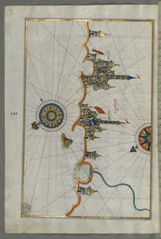
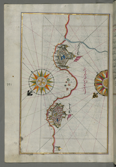
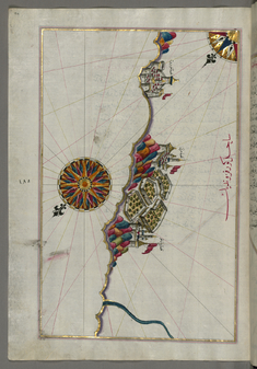
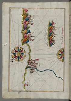
Map of the Calabrian Coast From Catanzaro to Siquillace
late 11th century AH/AD 17th century-early 12th century AH/AD 18th century (Ottoman)
W.658.212B
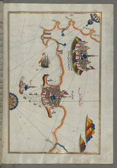
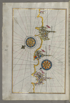
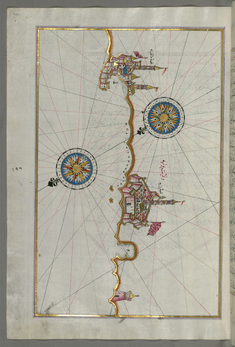
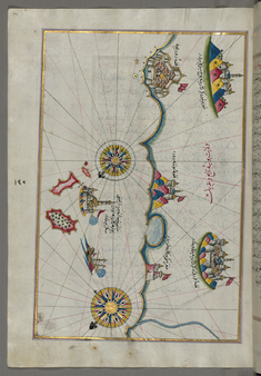
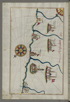
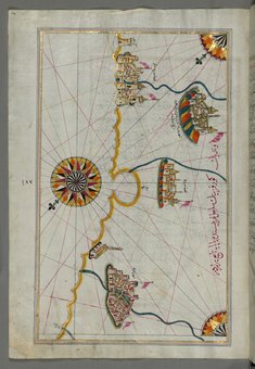
Map of the Eastern Coast of Calabria with the Towns of Crotone and Catanzaro
late 11th century AH/AD 17th century-early 12th century AH/AD 18th century (Ottoman)
W.658.211B
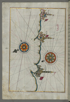
Map of the Eastern Coast of Calabria Around Rossano
late 11th century AH/AD 17th century-early 12th century AH/AD 18th century (Ottoman)
W.658.210A
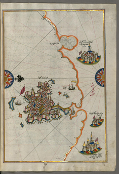
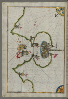
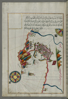
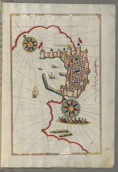
Map of the City of Taranto in the Province of Puglia
late 11th century AH/AD 17th century-early 12th century AH/AD 18th century (Ottoman)
W.658.208B
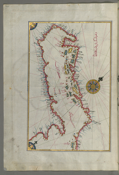
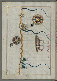
Map of the Coastlines and the Islands of the Adriatic Sea
late 11th century AH/AD 17th century-early 12th century AH/AD 18th century (Ottoman)
W.658.208A
Map of the Towns of Gallipoli and Nardo on the Italian Coast
late 11th century AH/AD 17th century-early 12th century AH/AD 18th century (Ottoman)
W.658.207B
Map of the Italian Coast from Lecce to Gallipoli
late 11th century AH/AD 17th century-early 12th century AH/AD 18th century (Ottoman)
W.658.206B
Map of the Port of Brindisi
late 11th century AH/AD 17th century-early 12th century AH/AD 18th century (Ottoman)
W.658.205A
Map of the Italian Coast Around Monopoli, South of Bari
late 11th century AH/AD 17th century-early 12th century AH/AD 18th century (Ottoman)
W.658.204A
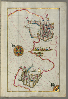
Map of the Town of Bari and the Surrounding Area
late 11th century AH/AD 17th century-early 12th century AH/AD 18th century (Ottoman)
W.658.203A
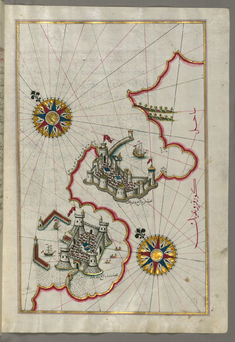
Map of the Italian Coast From Trani as Far as Molfetta
late 11th century AH/AD 17th century-early 12th century AH/AD 18th century (Ottoman)
W.658.202A
Map of the Italian Coastline From Barletta to Trani
late 11th century AH/AD 17th century-early 12th century AH/AD 18th century (Ottoman)
W.658.201A
Map of the Coastline from Mafredonia as Far as Barletta on the Italian Coast
late 11th century AH/AD 17th century-early 12th century AH/AD 18th century (Ottoman)
W.658.200A
Map of the Italian Coast Around Peschici North of Mafredonia
late 11th century AH/AD 17th century-early 12th century AH/AD 18th century (Ottoman)
W.658.199A
Map of the Italian Coast Between Termoli and Peschici
late 11th century AH/AD 17th century-early 12th century AH/AD 18th century (Ottoman)
W.658.198A
Map of the Towns Vasto and Termoli on the Italian Coast
late 11th century AH/AD 17th century-early 12th century AH/AD 18th century (Ottoman)
W.658.197A
Map of the Town of Lanciano and the Surrounding Fortresses
late 11th century AH/AD 17th century-early 12th century AH/AD 18th century (Ottoman)
W.658.196A
Map of the Italian Coast South of Ancona as Far as the Town of Pescara
late 11th century AH/AD 17th century-early 12th century AH/AD 18th century (Ottoman)
W.658.195A
Map of the Italian Coastline South of Ancona Including Tronto (?)
late 11th century AH/AD 17th century-early 12th century AH/AD 18th century (Ottoman)
W.658.194A
Map of the Fortresses and Towns South of Ancona, Including Loreto
late 11th century AH/AD 17th century-early 12th century AH/AD 18th century (Ottoman)
W.658.193A
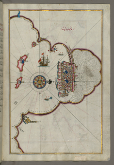
Map of the Fortress of Ancona and the Surrounding Area
late 11th century AH/AD 17th century-early 12th century AH/AD 18th century (Ottoman)
W.658.192A
Map of the Town of Urbino and the Surrounding Area
late 11th century AH/AD 17th century-early 12th century AH/AD 18th century (Ottoman)
W.658.191A
Map of the Italian Coastline from Pesaro South
late 11th century AH/AD 17th century-early 12th century AH/AD 18th century (Ottoman)
W.658.190A
Map of the Italian Coastline From Rimini South Towards Pesaro
late 11th century AH/AD 17th century-early 12th century AH/AD 18th century (Ottoman)
W.658.189A
Map of the Italian Coastline with the Cities of Ravenna and Cesena
late 11th century AH/AD 17th century-early 12th century AH/AD 18th century (Ottoman)
W.658.188A
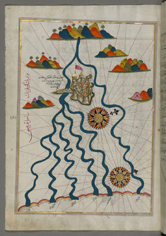
Map of the City of Ferrara with the Six Rivers Flowing into the Gulf of Venice
late 11th century AH/AD 17th century-early 12th century AH/AD 18th century (Ottoman)
W.658.187A
Map of the Coastline From Marano to Caorle, Province of Venice
late 11th century AH/AD 17th century-early 12th century AH/AD 18th century (Ottoman)
W.658.183B
Map of the Fortress of Trieste
late 11th century AH/AD 17th century-early 12th century AH/AD 18th century (Ottoman)
W.658.182B
Map of the Coastline from Muggia to Trieste
late 11th century AH/AD 17th century-early 12th century AH/AD 18th century (Ottoman)
W.658.181B
Map of the Coastline Between the Cities of Koper and Muggia
late 11th century AH/AD 17th century-early 12th century AH/AD 18th century (Ottoman)
W.658.180B