Piri Reis
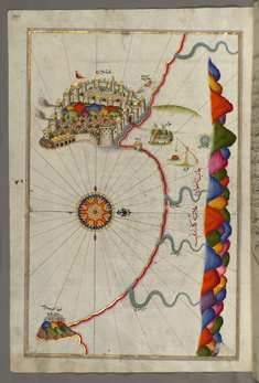
Map of the Fortress of Alanya
late 11th century AH/AD 17th century-early 12th century AH/AD 18th century (Ottoman)
W.658.329A
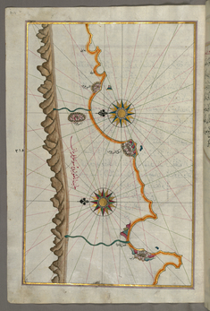
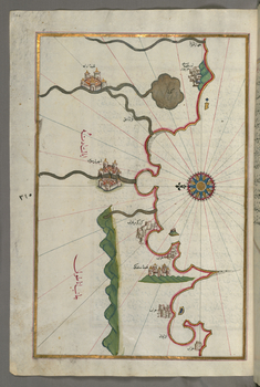
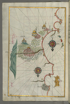
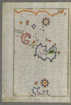
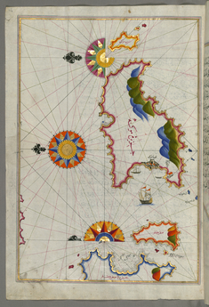
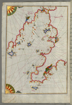
Map of the Anatolian Coast Around Anamur
late 11th century AH/AD 17th century-early 12th century AH/AD 18th century (Ottoman)
W.658.327A
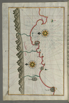
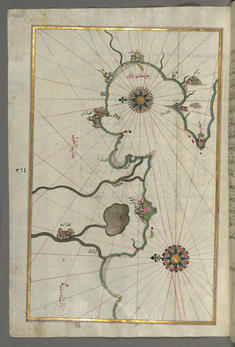
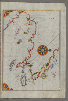
Map of the Anatolian Coast From Silfke to Anamur
late 11th century AH/AD 17th century-early 12th century AH/AD 18th century (Ottoman)
W.658.326A
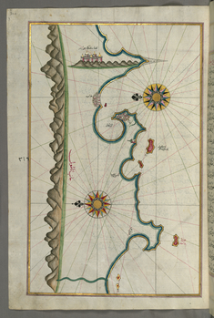
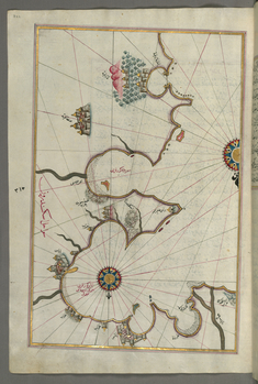
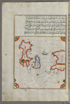
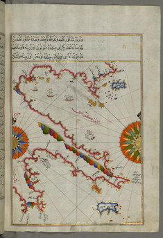
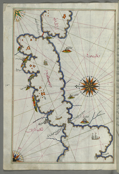
Map of the Anatolian Coast with the City of Silifke
late 11th century AH/AD 17th century-early 12th century AH/AD 18th century (Ottoman)
W.658.325A
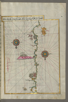
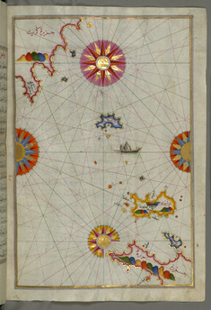
Map of the Anatolian Coast and the Cities Adana and Tarsus
late 11th century AH/AD 17th century-early 12th century AH/AD 18th century (Ottoman)
W.658.324A
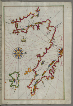
Map of the Anatolian Coast, the City of Iskenderun as Afar as the Shores of Adana
late 11th century AH/AD 17th century-early 12th century AH/AD 18th century (Ottoman)
W.658.323A
Map of the Eastern Mediterranean Coast and the Cities of Latakia and Antakya
late 11th century AH/AD 17th century-early 12th century AH/AD 18th century (Ottoman)
W.658.322A
Map of the Eastern Mediterranean Coast Beginning with the Island of Khatun as Far as Latakia
late 11th century AH/AD 17th century-early 12th century AH/AD 18th century (Ottoman)
W.658.320B
Map of the City of Tripoli
late 11th century AH/AD 17th century-early 12th century AH/AD 18th century (Ottoman)
W.658.319A
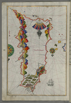
Map of Rhodes Island
late 11th century AH/AD 17th century-early 12th century AH/AD 18th century (Ottoman)
W.658.103A
Map of Nisyros Island South of Cos Island in the Eastern Aegean Sea
late 11th century AH/AD 17th century-early 12th century AH/AD 18th century (Ottoman)
W.658.106B
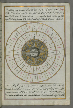
Western Hemisphere Within a Windrose
late 11th century AH/AD 17th century-early 12th century AH/AD 18th century (Ottoman)
W.658.24B
Map of Chalkis Island Off Rhodes Island
late 11th century AH/AD 17th century-early 12th century AH/AD 18th century (Ottoman)
W.658.104A
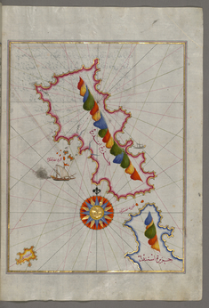
Map of Telos Island North of Chalkis Island in the Eastern Aegean Sea
late 11th century AH/AD 17th century-early 12th century AH/AD 18th century (Ottoman)
W.658.105B
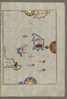
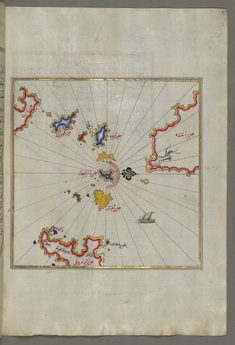
Map of Two Small Islands Between Amorgos and Cos in the Eastern Aegean Sea
late 11th century AH/AD 17th century-early 12th century AH/AD 18th century (Ottoman)
W.658.107B
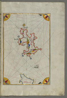
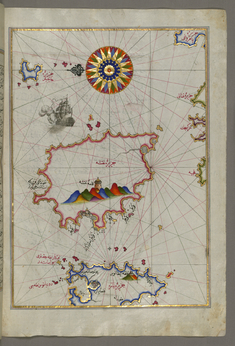
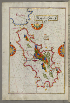
Map of the Island of Amorgos in the Southeastern Aegean Sea
late 11th century AH/AD 17th century-early 12th century AH/AD 18th century (Ottoman)
W.658.108B
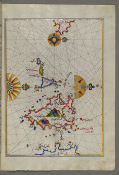
Map of Small Islands in the Region of Naxos and Amorgos in the Southeastern Aegean Sea
late 11th century AH/AD 17th century-early 12th century AH/AD 18th century (Ottoman)
W.658.109B
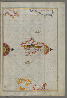
Map of the Island of Naxos in the Southeastern Aegean Sea
late 11th century AH/AD 17th century-early 12th century AH/AD 18th century (Ottoman)
W.658.110B
Map of the Island of Paros in the Aegean Sea
late 11th century AH/AD 17th century-early 12th century AH/AD 18th century (Ottoman)
W.658.112B
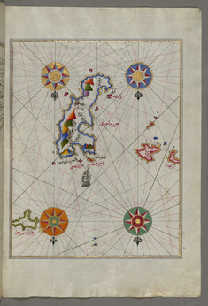
Map of the Island of Syros in the Aegean Sea
late 11th century AH/AD 17th century-early 12th century AH/AD 18th century (Ottoman)
W.658.113B
Map of the Islands of Delos and Rineia West of Mykonos Island in the Aegean Sea
late 11th century AH/AD 17th century-early 12th century AH/AD 18th century (Ottoman)
W.658.115A
Map of Mykonos Island in the Aegean Sea
late 11th century AH/AD 17th century-early 12th century AH/AD 18th century (Ottoman)
W.658.116A
Map of Tinos Island in the Aegean Sea
late 11th century AH/AD 17th century-early 12th century AH/AD 18th century (Ottoman)
W.658.117A
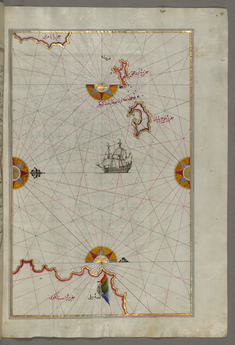
Map of the Island of Andros in the Northern Aegean Sea
late 11th century AH/AD 17th century-early 12th century AH/AD 18th century (Ottoman)
W.658.118B
Map of the Bay of Saronikos (Atene) with the City of Athens
late 11th century AH/AD 17th century-early 12th century AH/AD 18th century (Ottoman)
W.658.121A
Map of Argolikos Bay
late 11th century AH/AD 17th century-early 12th century AH/AD 18th century (Ottoman)
W.658.122B
Map of Argolikos Bay and Peloponnese Peninsula
late 11th century AH/AD 17th century-early 12th century AH/AD 18th century (Ottoman)
W.658.123B
Map of the Area Between the Peloponnese Peninsula and the Island of Crete
late 11th century AH/AD 17th century-early 12th century AH/AD 18th century (Ottoman)
W.658.124B
Map of the Peloponnese Peninsula with the Island of Kythira and the Lakonikos Bay
late 11th century AH/AD 17th century-early 12th century AH/AD 18th century (Ottoman)
W.658.127B
Map of the Cyclades Islands Between the Peloponnese Peninsula and Crete
late 11th century AH/AD 17th century-early 12th century AH/AD 18th century (Ottoman)
W.658.129B
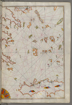
Map of the Islands of Zakynthos, Kefalonia and Lefkada in the Ionian Sea
late 11th century AH/AD 17th century-early 12th century AH/AD 18th century (Ottoman)
W.658.130A
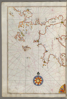
Map of Saronikos Bay
late 11th century AH/AD 17th century-early 12th century AH/AD 18th century (Ottoman)
W.658.133A