Piri Reis
Map of the Coastline From Izola as Far as Koper
late 11th century AH/AD 17th century-early 12th century AH/AD 18th century (Ottoman)
W.658.179B
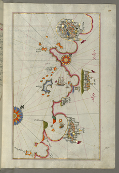
Map of the Coastline from Piran as Far as Izola
late 11th century AH/AD 17th century-early 12th century AH/AD 18th century (Ottoman)
W.658.178B
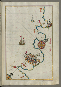
Map of the Coastline from Umag as Far as Piran
late 11th century AH/AD 17th century-early 12th century AH/AD 18th century (Ottoman)
W.658.177B
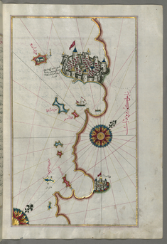
Map of the Coastline From Novi Grad as Far as Umag
late 11th century AH/AD 17th century-early 12th century AH/AD 18th century (Ottoman)
W.658.176B
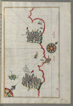
Map of the Coastline From Porec as Far as Novi Grad
late 11th century AH/AD 17th century-early 12th century AH/AD 18th century (Ottoman)
W.658.175B
Map of the Coastline From Rovinj as Far as the Fortress of Porec
late 11th century AH/AD 17th century-early 12th century AH/AD 18th century (Ottoman)
W.658.174B
Map of the Coastline from Rovinj North
late 11th century AH/AD 17th century-early 12th century AH/AD 18th century (Ottoman)
W.658.173B
Map of the Coastline from Pula to Rovinj
late 11th century AH/AD 17th century-early 12th century AH/AD 18th century (Ottoman)
W.658.172B
Map of the Coast from Medulin as Far as Pula
late 11th century AH/AD 17th century-early 12th century AH/AD 18th century (Ottoman)
W.658.171A
Map of the Coast North of the Medulin Fortress
late 11th century AH/AD 17th century-early 12th century AH/AD 18th century (Ottoman)
W.658.170A
Map of the Island of Unije South of Lošinj Island
late 11th century AH/AD 17th century-early 12th century AH/AD 18th century (Ottoman)
W.658.169A
Map of Cres, Lošinj and Unije Islands
late 11th century AH/AD 17th century-early 12th century AH/AD 18th century (Ottoman)
W.658.168A
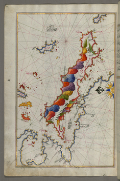
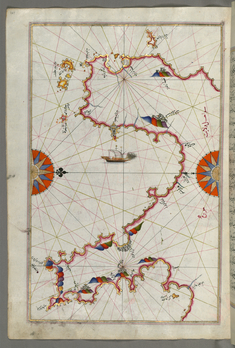
Map of the Island of Krk
late 11th century AH/AD 17th century-early 12th century AH/AD 18th century (Ottoman)
W.658.166A
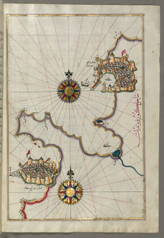
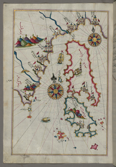
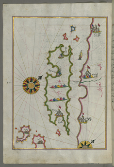
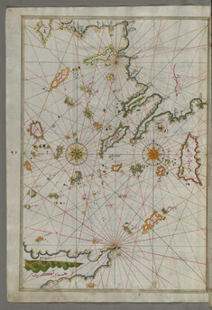
Map of the Islands of Pag and Rab
late 11th century AH/AD 17th century-early 12th century AH/AD 18th century (Ottoman)
W.658.165A
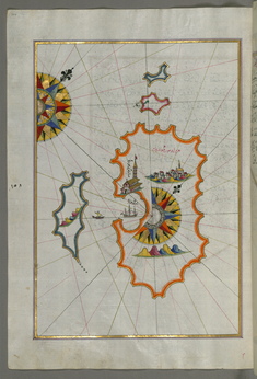
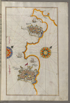
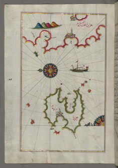
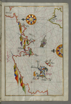
Map of Premuda Island West Off the Pag Island
late 11th century AH/AD 17th century-early 12th century AH/AD 18th century (Ottoman)
W.658.164A
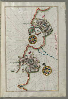
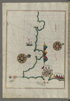
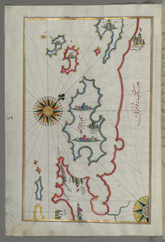
Map of the Island of Rab
late 11th century AH/AD 17th century-early 12th century AH/AD 18th century (Ottoman)
W.658.163A
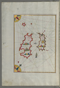
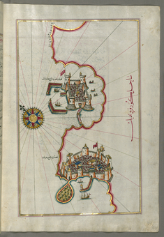
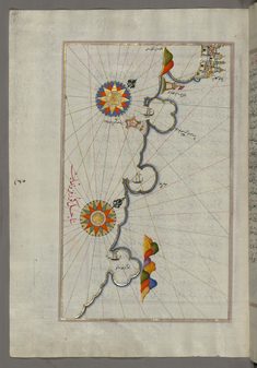
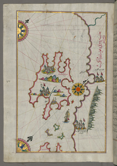
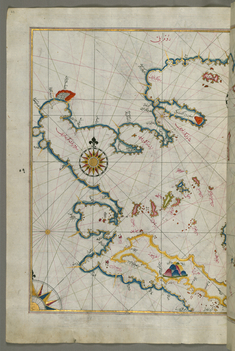
Map of Two Unidentified Islands in the Vicinity of Pag Island.
late 11th century AH/AD 17th century-early 12th century AH/AD 18th century (Ottoman)
W.658.162A
Leaf from Book on Navigation
late 11th century AH/AD 17th century-early 12th century AH/AD 18th century (Ottoman)
W.658.135B
Leaf from Book on Navigation
late 11th century AH/AD 17th century-early 12th century AH/AD 18th century (Ottoman)
W.658.136A
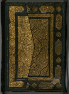
Book on Navigation
late 11th century AH/AD 17th century-early 12th century AH/AD 18th century (Ottoman)
W.658
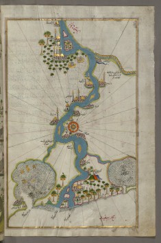
Map of the River Nile From Its Estuary South
late 11th century AH/AD 17th century-early 12th century AH/AD 18th century (Ottoman)
W.658.304B
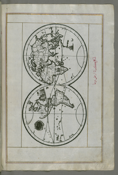
World Map in a Double Hemisphere
late 11th century AH/AD 17th century-early 12th century AH/AD 18th century (Ottoman)
W.658.40B
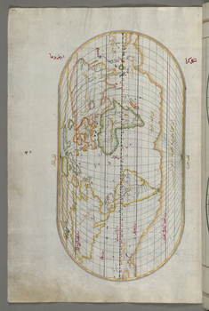
Oval World Map
late 11th century AH/AD 17th century-early 12th century AH/AD 18th century (Ottoman)
W.658.41A
Map of the Islands of Skyros and Euboea
late 11th century AH/AD 17th century-early 12th century AH/AD 18th century (Ottoman)
W.658.56A
Map of the Coastline of the Western Aegean Sea as Far South as the Island of Euboea
late 11th century AH/AD 17th century-early 12th century AH/AD 18th century (Ottoman)
W.658.63A
Map of the Northeastern Tip of Rhodes Island Facing the Anatolian Coast with the Island of Syme
late 11th century AH/AD 17th century-early 12th century AH/AD 18th century (Ottoman)
W.658.100B
Map of the Islands of the Aegean Sea Including Chios, Cos, Rhodes and Crete
late 11th century AH/AD 17th century-early 12th century AH/AD 18th century (Ottoman)
W.658.101A
Map of Messiniakos Bay
late 11th century AH/AD 17th century-early 12th century AH/AD 18th century (Ottoman)
W.658.129A
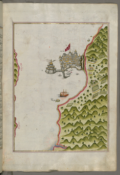
Map of the Methana Fortress in the Saronikos Bay
late 11th century AH/AD 17th century-early 12th century AH/AD 18th century (Ottoman)
W.658.130B
Leaf from Book on Navigation
late 11th century AH/AD 17th century-early 12th century AH/AD 18th century (Ottoman)
W.658.185A
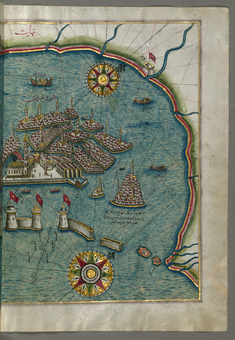
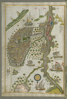
Map of the Eastern Part of the City of Venice
late 11th century AH/AD 17th century-early 12th century AH/AD 18th century (Ottoman)
W.658.185B