Piri Reis
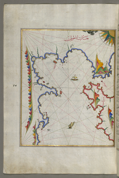
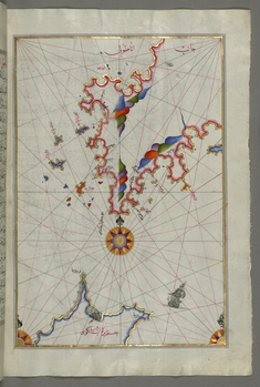
Map of the Area West of the Island of Thasos and the Ayion Oros Peninsula
late 11th century AH/AD 17th century-early 12th century AH/AD 18th century (Ottoman)
W.658.49A
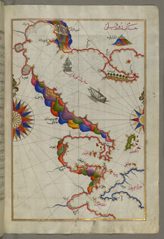
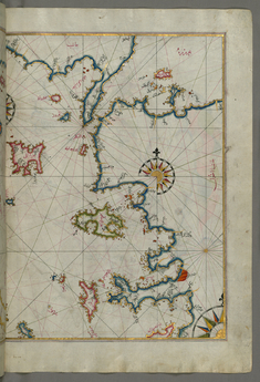
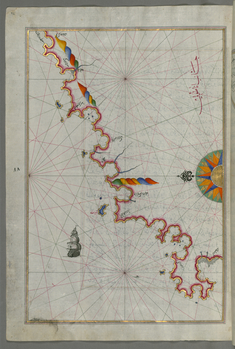
Map of the Bay of Salonica
late 11th century AH/AD 17th century-early 12th century AH/AD 18th century (Ottoman)
W.658.51A
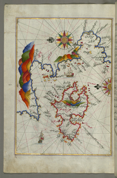
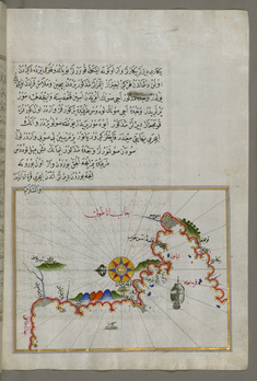
Map of the Bay of Salonica and the Western Coastline
late 11th century AH/AD 17th century-early 12th century AH/AD 18th century (Ottoman)
W.658.52B
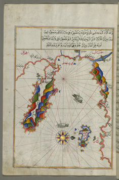
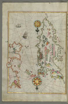
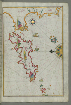
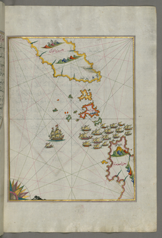
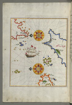
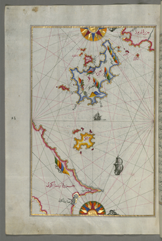
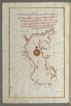
Map of the Island of Midilli in the Northeastern Aegean Sea
late 11th century AH/AD 17th century-early 12th century AH/AD 18th century (Ottoman)
W.658.62A
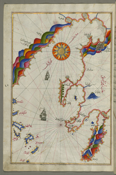
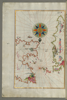
Map of the Sea of Marmara and the Islands of the Eastern Aegean Sea from Semendrek to Chios
late 11th century AH/AD 17th century-early 12th century AH/AD 18th century (Ottoman)
W.658.62B
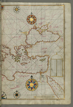
Map of the Eastern Mediterranean, Aegean and the Black Sea
late 11th century AH/AD 17th century-early 12th century AH/AD 18th century (Ottoman)
W.658.63B
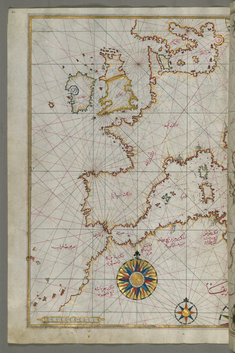
Map of Western Europe and North Africa
late 11th century AH/AD 17th century-early 12th century AH/AD 18th century (Ottoman)
W.658.64A
Map of the Anatolian Coast Around the Bay of Izmir
late 11th century AH/AD 17th century-early 12th century AH/AD 18th century (Ottoman)
W.658.68B
Map of Chios Island Facing Kysos Fortress on the Anatolian Side
late 11th century AH/AD 17th century-early 12th century AH/AD 18th century (Ottoman)
W.658.70A
Detailed Map of Sakiz Island with its Fortress and Other Topographical Features
late 11th century AH/AD 17th century-early 12th century AH/AD 18th century (Ottoman)
W.658.73A
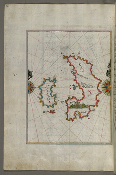
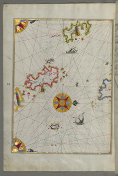
Map of the the Island of Psara West of Chios
late 11th century AH/AD 17th century-early 12th century AH/AD 18th century (Ottoman)
W.658.74A
Map of the Anatolian Coast Facing the Island of Samos
late 11th century AH/AD 17th century-early 12th century AH/AD 18th century (Ottoman)
W.658.75B
Map of the Anatolian Coast Facing the Island of Samos
late 11th century AH/AD 17th century-early 12th century AH/AD 18th century (Ottoman)
W.658.77A
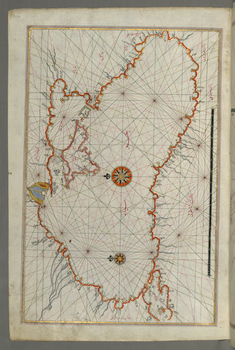
Map of the Island of Samos
late 11th century AH/AD 17th century-early 12th century AH/AD 18th century (Ottoman)
W.658.79B
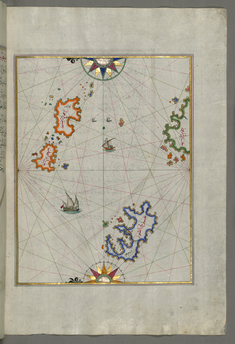
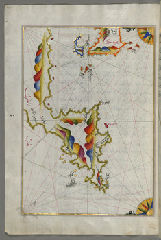
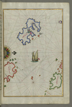
Map of Two Small Islands Off the Coast of Anatolia
late 11th century AH/AD 17th century-early 12th century AH/AD 18th century (Ottoman)
W.658.80B
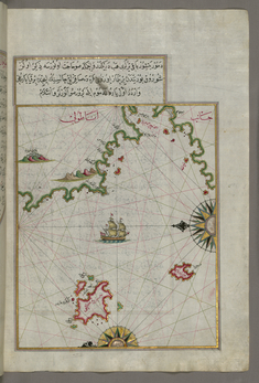
Map of Several Islands of the Eastern Aegean Sea Including: Leros and Patmos
late 11th century AH/AD 17th century-early 12th century AH/AD 18th century (Ottoman)
W.658.81B
Map of the Area Between the Islands of Ikaria and Samos
late 11th century AH/AD 17th century-early 12th century AH/AD 18th century (Ottoman)
W.658.82B
Map of Syme Island North-west of Rhodes Island
late 11th century AH/AD 17th century-early 12th century AH/AD 18th century (Ottoman)
W.658.99A
Map of the Bay of Kerme East of Cos Island
late 11th century AH/AD 17th century-early 12th century AH/AD 18th century (Ottoman)
W.658.97B
Map of the Island of Cos Off the Anatolian Coast
late 11th century AH/AD 17th century-early 12th century AH/AD 18th century (Ottoman)
W.658.95A
Map of the Anatolian Coast Facing the Island of Cos
late 11th century AH/AD 17th century-early 12th century AH/AD 18th century (Ottoman)
W.658.93B
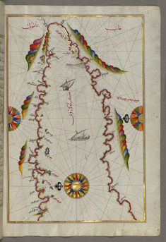
Map of the Anatolian Coast Along the Kerme Bay
late 11th century AH/AD 17th century-early 12th century AH/AD 18th century (Ottoman)
W.658.92A
Map of the Anatolian Coast and the Small Kara Island
late 11th century AH/AD 17th century-early 12th century AH/AD 18th century (Ottoman)
W.658.90B
Map of the Island of Cos Facing the Anatolian Mainland
late 11th century AH/AD 17th century-early 12th century AH/AD 18th century (Ottoman)
W.658.89A
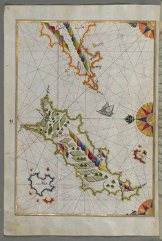
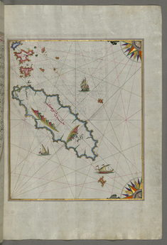
Map of the Island of Kalimnos
late 11th century AH/AD 17th century-early 12th century AH/AD 18th century (Ottoman)
W.658.88A
Map of the Island of Leros
late 11th century AH/AD 17th century-early 12th century AH/AD 18th century (Ottoman)
W.658.86A
Map of the Island of Patmos
late 11th century AH/AD 17th century-early 12th century AH/AD 18th century (Ottoman)
W.658.84B
Map of the Island of Ikaria in the Eastern Aegean Sea
late 11th century AH/AD 17th century-early 12th century AH/AD 18th century (Ottoman)
W.658.83B
Map of the Caspian Sea
late 11th century AH/AD 17th century-early 12th century AH/AD 18th century (Ottoman)
W.658.374A
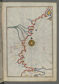
Map of the Black Sea Coastline
late 11th century AH/AD 17th century-early 12th century AH/AD 18th century (Ottoman)
W.658.373A
Map of the Sea of Marmara, Bosporus Strait and the Black Sea
late 11th century AH/AD 17th century-early 12th century AH/AD 18th century (Ottoman)
W.658.372B
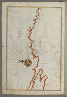
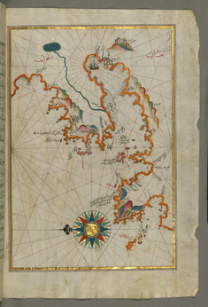
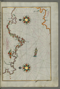
Map of the Coast of the Black Sea from Istanbul to Geresun
late 11th century AH/AD 17th century-early 12th century AH/AD 18th century (Ottoman)
W.658.371A