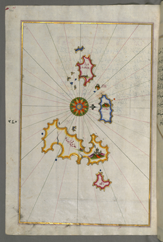
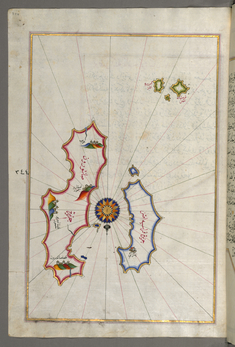
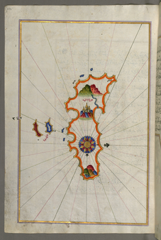
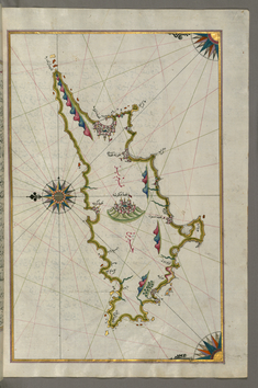
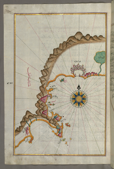
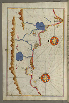
Piri Reis
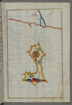
Map of the Island of Mir 'Ali
late 11th century AH/AD 17th century-early 12th century AH/AD 18th century (Ottoman)
W.658.369B
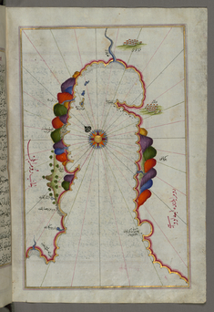
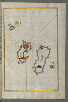
Map of the Island of Marmara in the Sea of Marmara
late 11th century AH/AD 17th century-early 12th century AH/AD 18th century (Ottoman)
W.658.368B
Leaf from Book on Navigation
late 11th century AH/AD 17th century-early 12th century AH/AD 18th century (Ottoman)
W.658.367B
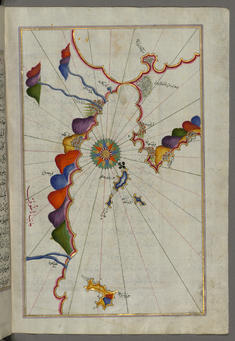
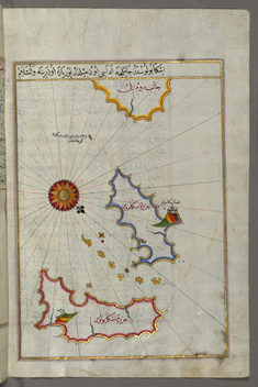
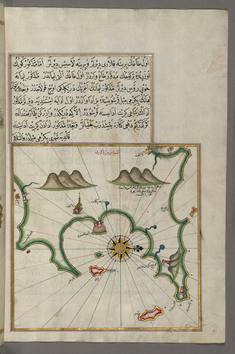
Map of Part of the Coastline of the Sea of Marmara, with the Town of Kavak
late 11th century AH/AD 17th century-early 12th century AH/AD 18th century (Ottoman)
W.658.366B
Leaf from Book on Navigation
late 11th century AH/AD 17th century-early 12th century AH/AD 18th century (Ottoman)
W.658.365B
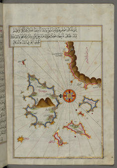
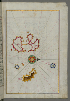
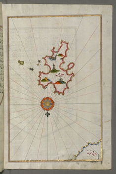
Map of Aloneses and Unidentified Islands
late 11th century AH/AD 17th century-early 12th century AH/AD 18th century (Ottoman)
W.658.364B
Leaf from Book on Navigation
late 11th century AH/AD 17th century-early 12th century AH/AD 18th century (Ottoman)
W.658.363B
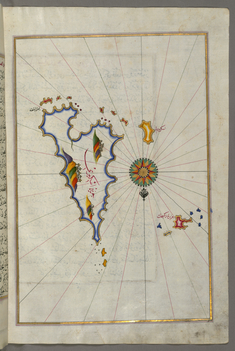
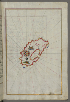
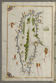
Map of Skyros Island
late 11th century AH/AD 17th century-early 12th century AH/AD 18th century (Ottoman)
W.658.362B
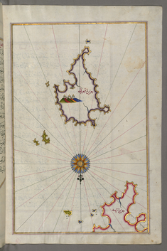
Map of Keos Island
late 11th century AH/AD 17th century-early 12th century AH/AD 18th century (Ottoman)
W.658.361B
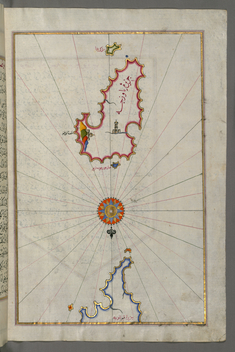
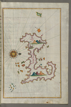
Map of Kythnos Island
late 11th century AH/AD 17th century-early 12th century AH/AD 18th century (Ottoman)
W.658.360B
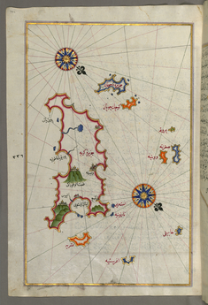
Map of Serofos (Koyunluga) Island
late 11th century AH/AD 17th century-early 12th century AH/AD 18th century (Ottoman)
W.658.359B
Leaf from Book on Navigation
late 11th century AH/AD 17th century-early 12th century AH/AD 18th century (Ottoman)
W.658.358B
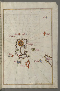
Map of Melos Island
late 11th century AH/AD 17th century-early 12th century AH/AD 18th century (Ottoman)
W.658.357B

Map of the Islands Folegandros and Melos
late 11th century AH/AD 17th century-early 12th century AH/AD 18th century (Ottoman)
W.658.356A
Map of the Islands Folegandros and Ios
late 11th century AH/AD 17th century-early 12th century AH/AD 18th century (Ottoman)
W.658.355A
Map of Two Islands: Santorini and Thera in the Aegean Sea, North of Crete
late 11th century AH/AD 17th century-early 12th century AH/AD 18th century (Ottoman)
W.658.354A
Map of the Island of Anafi, East of Thera
late 11th century AH/AD 17th century-early 12th century AH/AD 18th century (Ottoman)
W.658.353A
Map of the Island of Crete
late 11th century AH/AD 17th century-early 12th century AH/AD 18th century (Ottoman)
W.658.352A
Map Fragment of the Island of Crete
late 11th century AH/AD 17th century-early 12th century AH/AD 18th century (Ottoman)
W.658.351B
Map of the Islands of Karpathos and Kasos
late 11th century AH/AD 17th century-early 12th century AH/AD 18th century (Ottoman)
W.658.346A
Map of the Istanbul Island
late 11th century AH/AD 17th century-early 12th century AH/AD 18th century (Ottoman)
W.658.344B
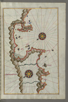
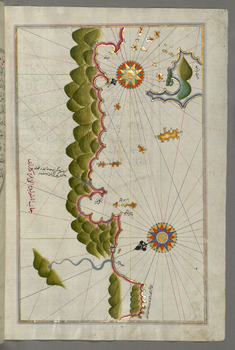
Map of Unidentified Islands Off the Southern Anatolian Coast
late 11th century AH/AD 17th century-early 12th century AH/AD 18th century (Ottoman)
W.658.343B
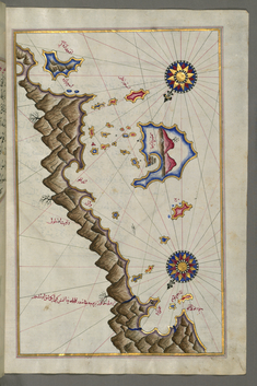
Map of Unidentified Islands Off the Southern Anatolian Coast
late 11th century AH/AD 17th century-early 12th century AH/AD 18th century (Ottoman)
W.658.342B
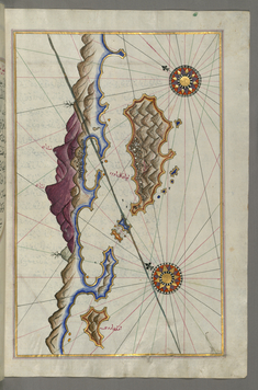
Map of Unidentified Islands Off the Southern Anatolian Coast
late 11th century AH/AD 17th century-early 12th century AH/AD 18th century (Ottoman)
W.658.341B
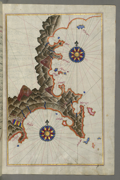
Map of Unidentified Islands Off the Southern Anatolian Coast
late 11th century AH/AD 17th century-early 12th century AH/AD 18th century (Ottoman)
W.658.340B
Map of Unidentified Islands Off the Southern Anatolian Coast
late 11th century AH/AD 17th century-early 12th century AH/AD 18th century (Ottoman)
W.658.339B
Map of Unidentified Islands Off the Southern Anatolian Coast
late 11th century AH/AD 17th century-early 12th century AH/AD 18th century (Ottoman)
W.658.338B
Map of the Islands Off the Shores of Finike
late 11th century AH/AD 17th century-early 12th century AH/AD 18th century (Ottoman)
W.658.337B
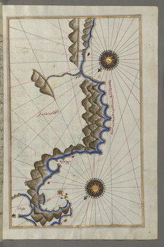
Map of the Anatolian Coast East of Finike
late 11th century AH/AD 17th century-early 12th century AH/AD 18th century (Ottoman)
W.658.336B
Map of the Island of Cyprus
late 11th century AH/AD 17th century-early 12th century AH/AD 18th century (Ottoman)
W.658.334B
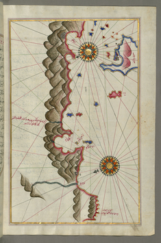
Map of the Anatolian Coast From Alanya to Andalye
late 11th century AH/AD 17th century-early 12th century AH/AD 18th century (Ottoman)
W.658.331A
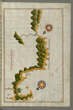
Map of the Anatolian Coast from Alanya to Andalye
late 11th century AH/AD 17th century-early 12th century AH/AD 18th century (Ottoman)
W.658.330A